The french version of this article is available here.
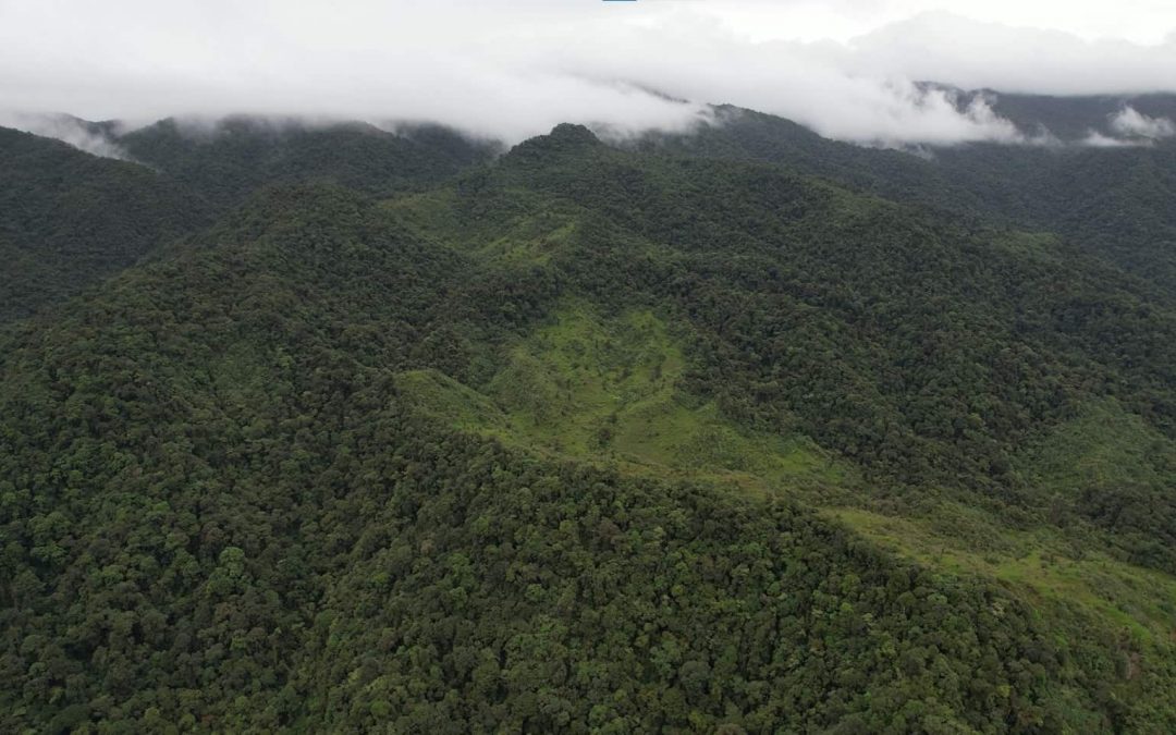
In July of this year (2021), the Imperfect Plan team performed an expedition into the jungles of western Panama, north of the town of Boquete. Our primary objectives entailed mapping the trail and gathering information in the jungle where Kris Kremers and Lisanne Froon disappeared on April 1st, 2014.
Before the expedition, we were well aware that finding conclusive evidence regarding the disappearance case of Kris Kremers and Lisanne Froon was highly unlikely, and that was not our goal. Our goal was to gather information about the trails, key locations and the general conditions. The disappearance of Kris and Lisanne took place more than seven years ago, yet we knew there was still ample information that could be gathered. That information could potentially answer some important questions about the disappearance case.
For Newcomers: You can review the articles we previously wrote about the disappearance on our Case Articles page. Furthermore, you can read about our fundraising efforts and our team updates from when we originally started planning our trip to Panama.
Before we embarked on this trip to Panama, we knew that there would be many hurdles. Fortunately, our team was able to gather a lot of information in the jungle, much of which offers some important insights about the area of the jungle where Kris Kremers and Lisanne Froon would have been during the initial moments of their disappearance.
We’ll leave it up to you to decide which information is important.
During our time there, we mapped the trail, gathered relevant GPS coordinates, took photos with a Canon Powershot (the same model of Lisanne Froon’s camera found in the blue backpack), captured aerial drone footage, captured GoPro footage, documented environmental conditions, wrote a lot of notes, along with many other pre-determined tasks.
Both Panama expeditions were very challenging physically and psychologically. The conditions of the jungle in the high elevations of the mountains are not accommodating. It’s unlike any camping or hiking adventure we’ve done anywhere else in the world.
More than one article is necessary to convey all of this information.
We figure it’s much easier to consume the information if it’s properly organized, rather than being written in a single 100+ page article. This approach will also give us more time to write in-depth articles and it’ll make it easier to reference/link the articles in the future. As you’ll see below, this overview article itself is fairly comprehensive. We wanted to touch on as much information as possible while also staying organized.
Let’s dive in.
Our Team
During our trip to Panama, our team included four people, three of which were in Panama during the expeditions.
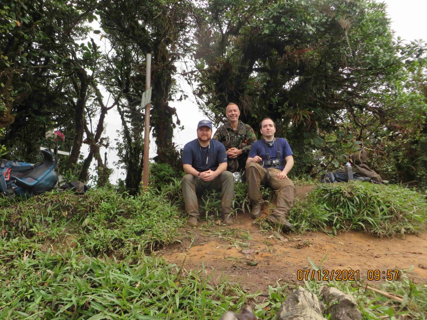
Romain, Yann and Chris flew to Panama to complete the objectives we had planned.
| Team Member | Primary Role | Background | Country |
|---|---|---|---|
| Chris | Preparations & Fundly | Software Engineer & Outdoors Experience | USA |
| Romain | Drone & Video | Law and communication | France |
| Yann | Navigation & Jungle Expertise | Survival Expert & Military Commando | France |
| Matt | Remote Support | Technology & Data Expert | Canada |
Total Amount Raised: $3,909
Donations were spent primarily on flights and the AirBNB for team members.
Approximate Amount Spent: $18,000
Yann was a paid by our team to assist us in completing our objectives. Yann operates a survival school in north-west Panama called Survie Jungle. He’s been involved in search and rescue operations. He’s very familiar with human behavior in jungle conditions and has taught anti-poaching strategies to international organizations, including government security agencies. Yann was well informed about the disappearance case of Kris Kremers and Lisanne Froon. After the expedition, we wrote a review about our experience with him.
Matt was our remote support. We maintained daily communication with Matt through satellite communication. Matt was vital for exchanging case notes and monitoring our GPS location. He also acted as a single relay point in case of an emergency. Although there were a couple minor injuries, we were fortunate not to face any emergency situations.
Arrival In Boquete, Panama
Determining when we should arrive in Panama was our initial big challenge. We had to shift our plans many times as unexpected challenges arose. With the Coronavirus pandemic, flight limitations, hurdles with work and school, as well as the approaching rainy season in Panama, we all needed to ensure that our plans were mutually aligned in a way that also would be optimal for conducting our research in Panama.
Seasonal Timing
The rainy season in Panama doesn’t increase substantially until about mid-to-late September. October and November generally receive the heaviest rainfall. We conducted our expeditions in July and August of 2021, when the weather was very mild.
Our team could have waited until April of the following year in hopes to maximize the similarity in weather conditions to when Kris and Lisanne disappeared in April of 2014. However, postponing the trip for more time would have presented numerous challenges for our team. So we decided not to postpone our trip any further.
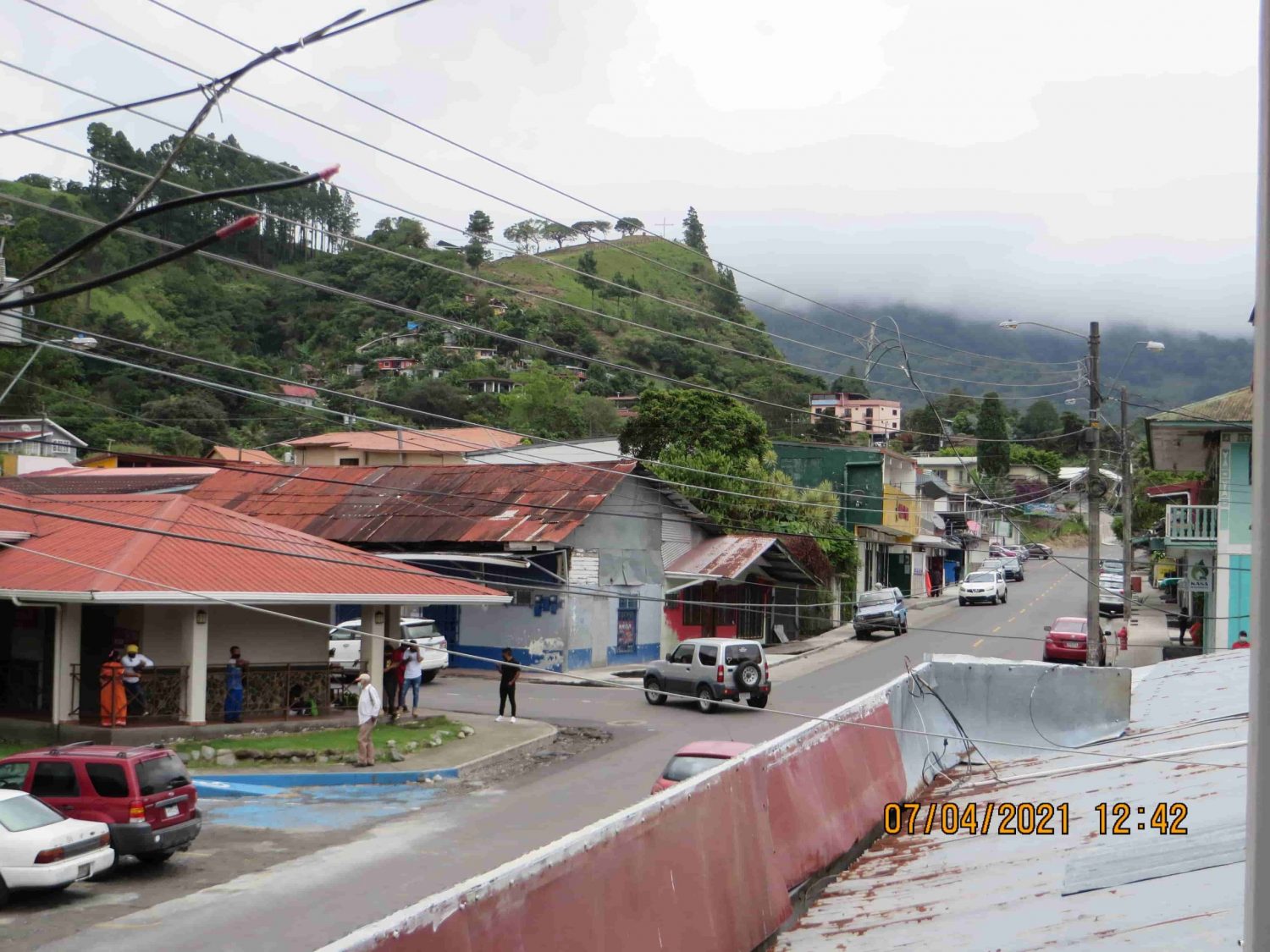
Romain arrived in Panama first and secure our AirBNB, where we would charge our electronics, organize our gear, store our food supplies and do an overview of our plans and the existing case information. This AirBNB would be our center of operations.
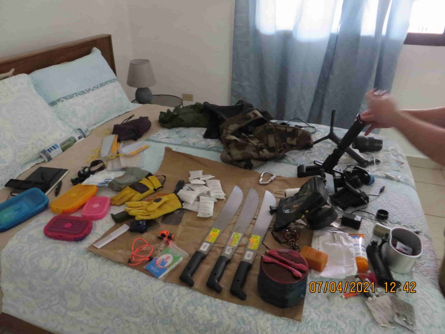
About two weeks later, Chris and Yann arrived in Panama and joined with Romain at the AirBNB in Boquete. Immediately we started reviewing our gear and preparing for the first expedition.
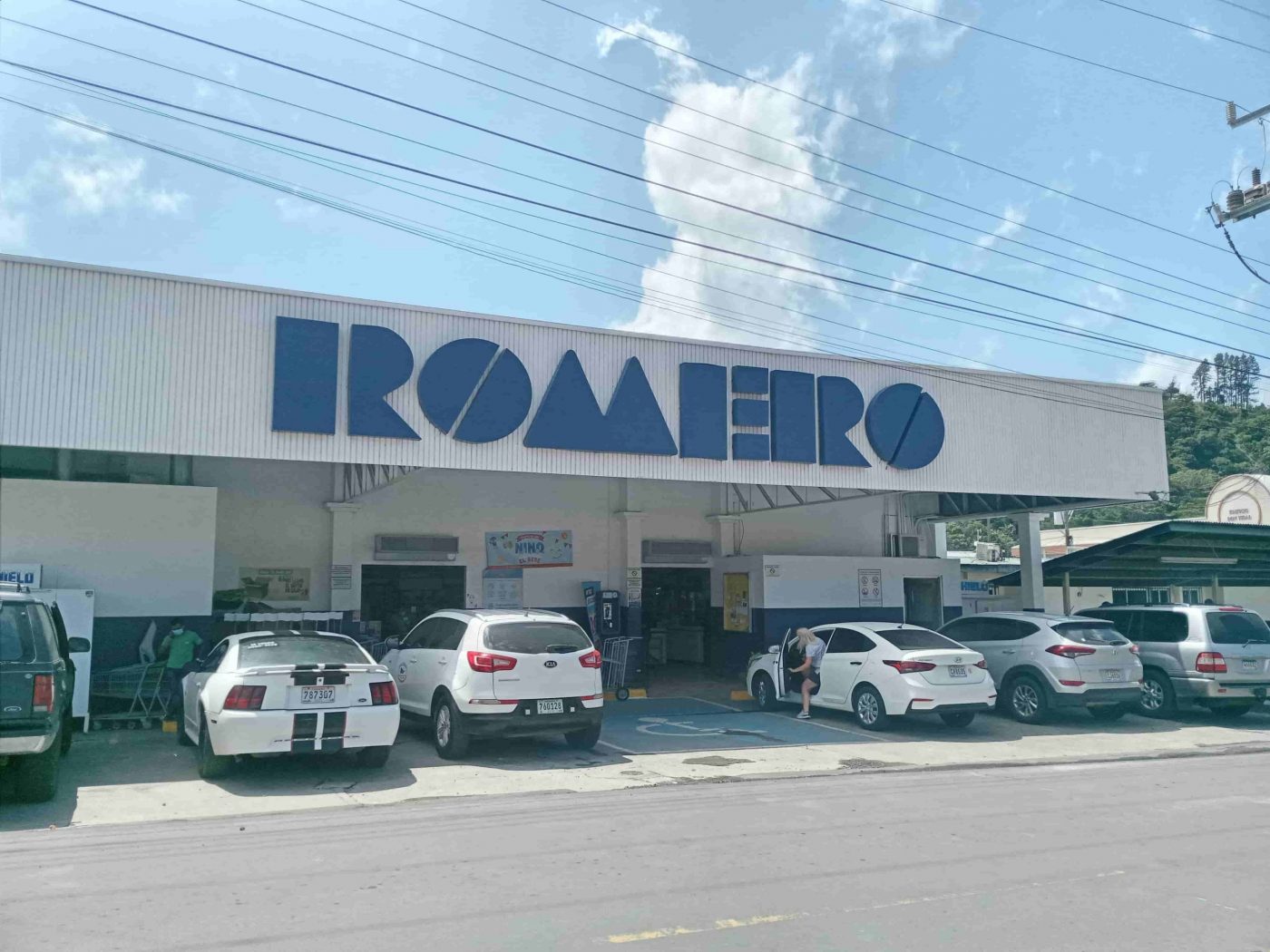
Yann assisted us in determining which foods would be optimal to bring with us, with consideration to the jungle conditions and our necessary caloric intake. We did our food shopping in Boquete. Some foods were purchased at Romero food store, the same grocery store where Kris and Lisanne had bought some groceries during their stay in Boquete.
Some items that we needed were difficult to find. For example, we couldn’t bring butane nor propane fuel in the cargo hold of the plane when flying to Panama, so we had to purchase a propane torch in Boquete before our expedition. Camping isn’t common in areas around Boquete, so it was difficult for us to find a propane torch and other last minute items that we needed. In the end, we found alternative options that worked well for us.
Two Expeditions
We performed two different expeditions with specific objectives in mind for each. We grouped our objectives according to which areas we would focus our time:
Expedition #1: Focussed on the areas near the Mirador & Photo 508 location.
Expedition #2: Visited the monkey bridges and Alto Romero.
Day Trip: Swimming Photo Location
This article is going to focus primarily on Expedition 1, while also providing some light details about Expedition 2. We’ll cover a brief day-trip we took to the swimming photo location. Later we’ll publish a second article to cover Expedition 2 in detail.
In addition to these two expeditions, we also took numerous smaller day-trips to the Mirador to gather information, such as logging the time to hike to the Mirador, capturing drone footage, etc.
Maps & GPS Coordinates
For convenience, we’ve organized all of GPS coordinates and map data from Expedition #1 into its own article.
Article: Expedition 1 – Maps & Coordinates
We’ll be referring to those maps and GPS coordinates in this article.
It’s important to note that Expedition #2 maps and data will be provided at a later date. During Expedition #2 we relied heavily on GPS data logged by our drone, so we’ll need some time to compile the important GPS coordinates and flight paths that are currently embedded into the drone KML log files.
Expedition #1 Overview
Duration: 6 Days, Round-Trip Camping Expedition
Date Started: July 6th, 2021
Date Completed: July 12, 2021
Focus: Mirador, Photo #508 Location, Gathering Environmental Data, River Searches, Paddock
Team: Chris, Romain, Yann
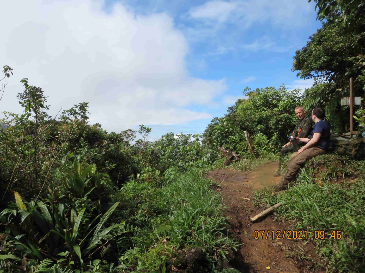
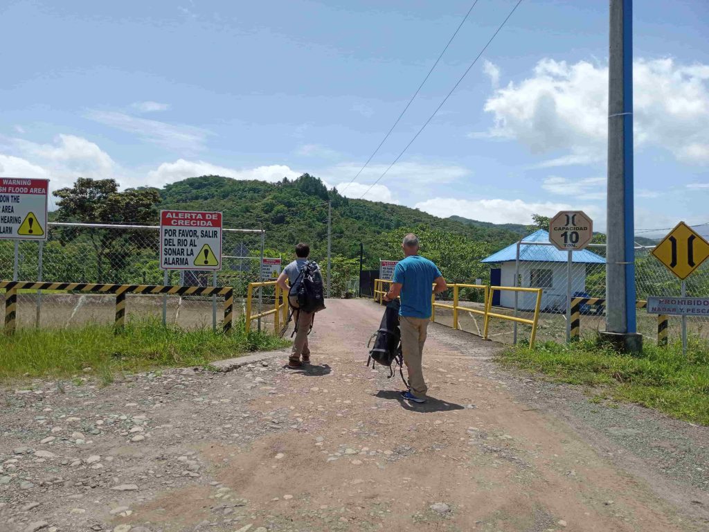
Exp #1: El Pianista Trail Hike
The El Pianista Trail starts at the Il Pianista restaurant, which is located on the northern outskirts of Boquete. There’s not much activity in the area and a taxi or local bus is necessary to arrive here.
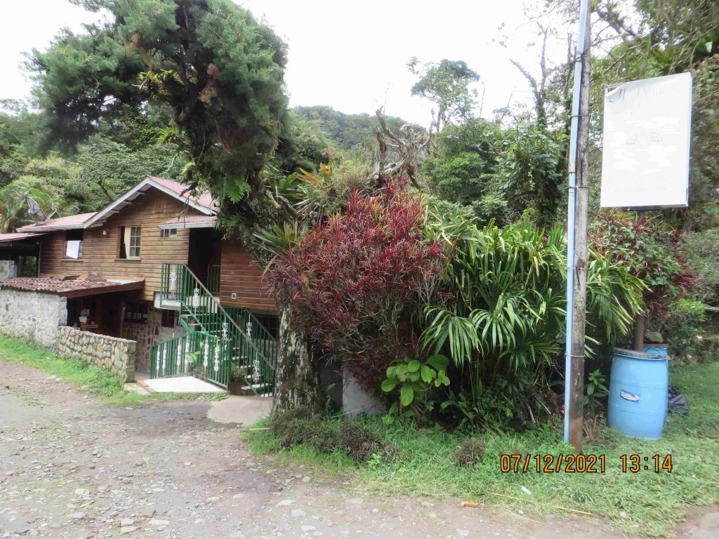
Il Pianista Restaurant 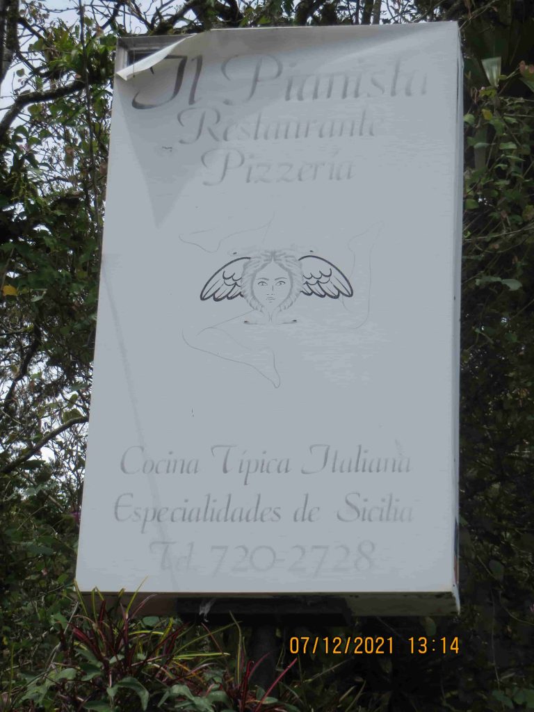
Il Pianista Sign


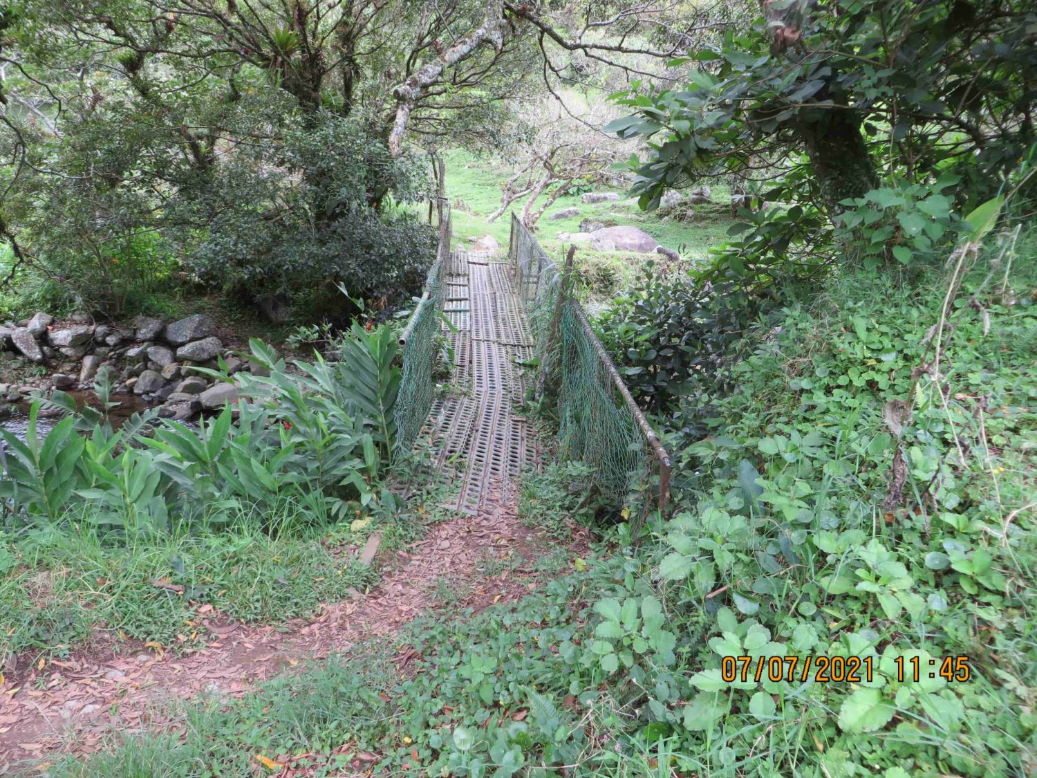
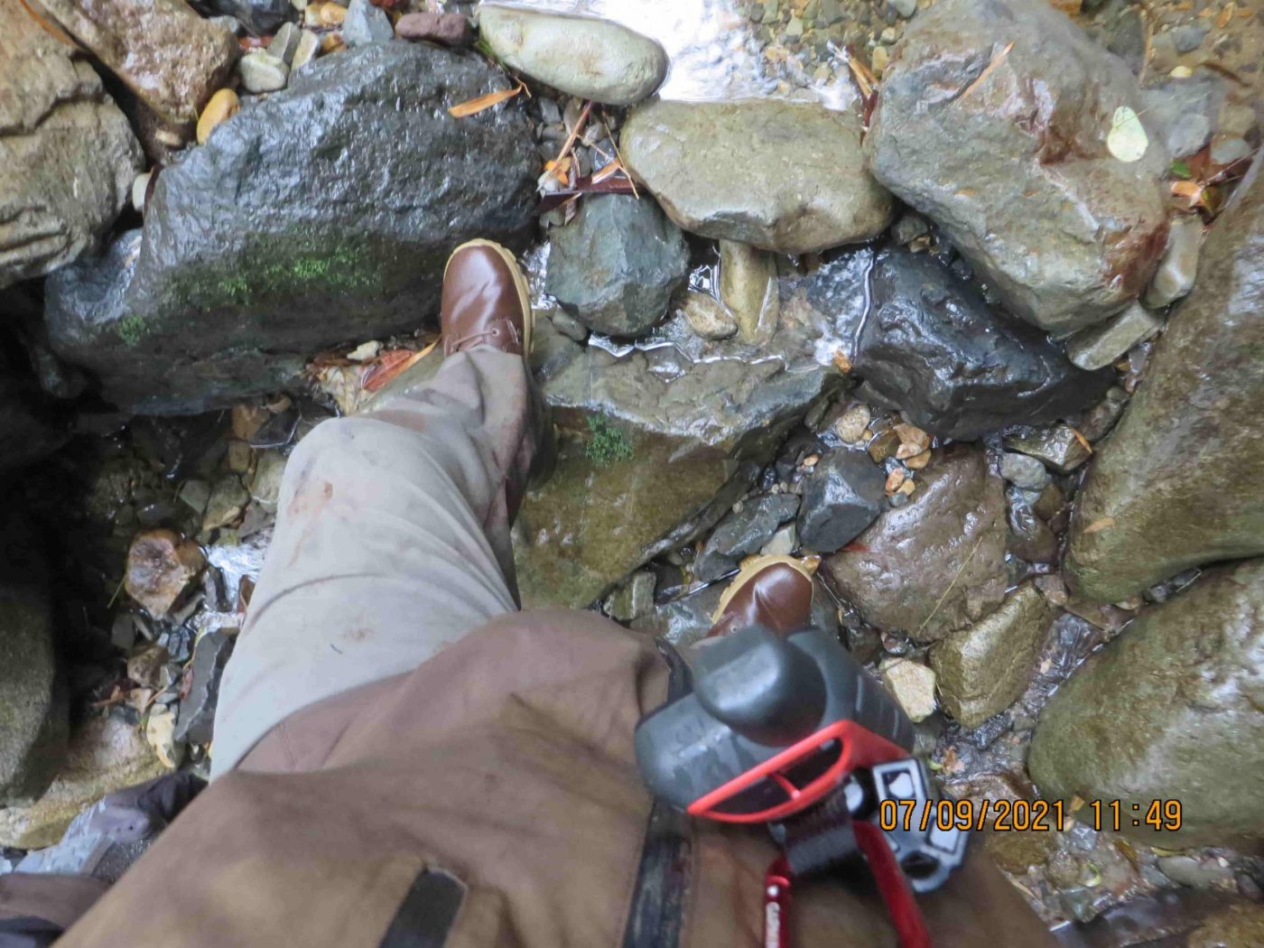
During the first 10 minutes of our hike, we came to the location of the photo where Kris Kremers was seen standing on a small bridge. Here we found that same small bridge:
After the bridge, we were surrounded by open pastures:
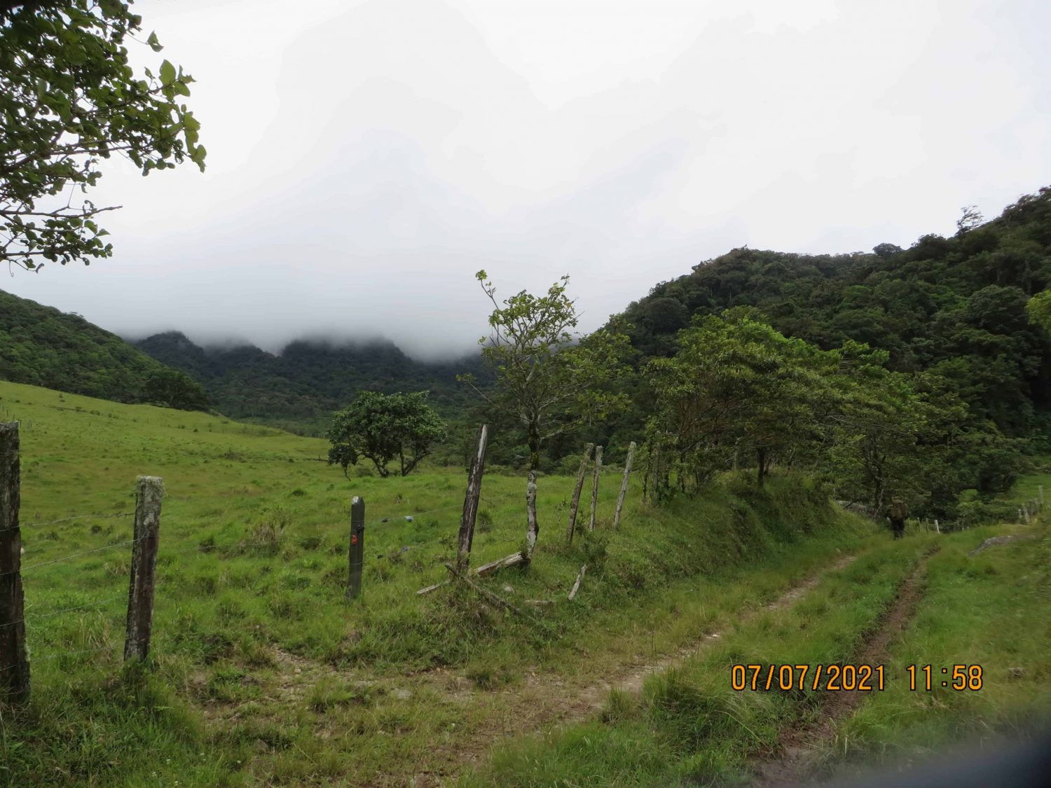
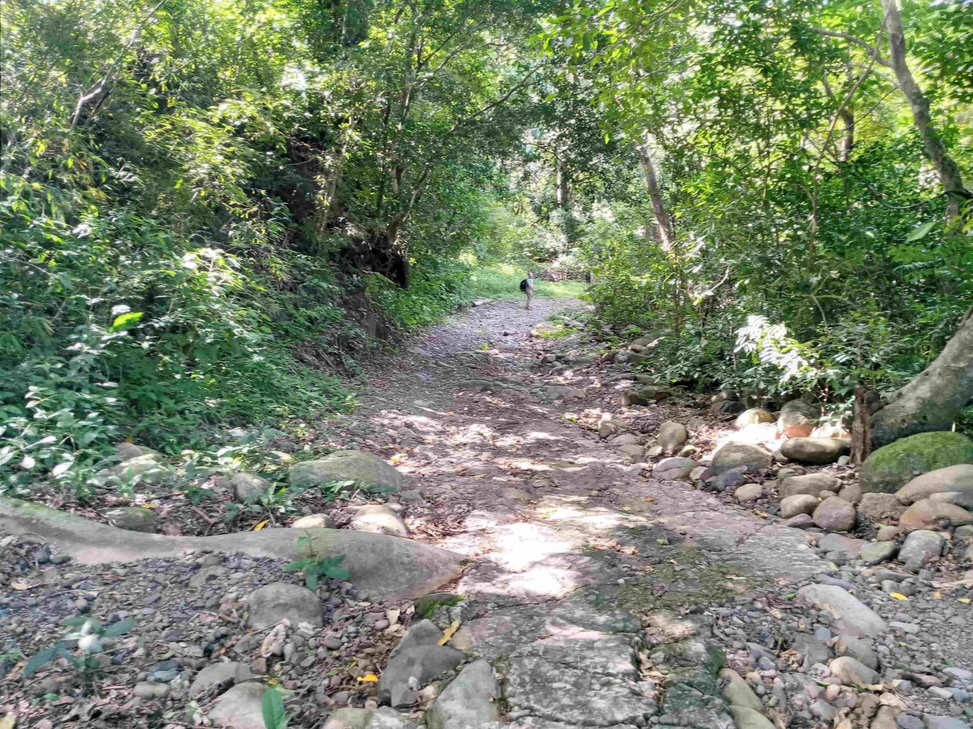
Soon the trial narrowed and was rocky for a while.
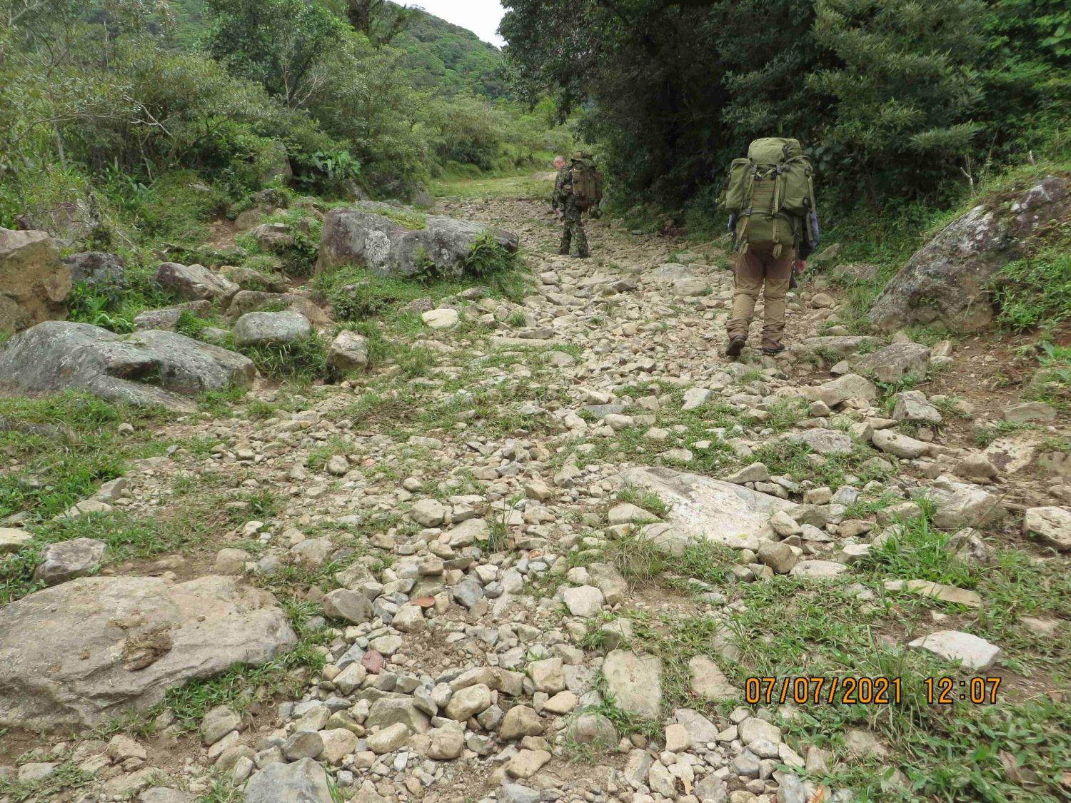
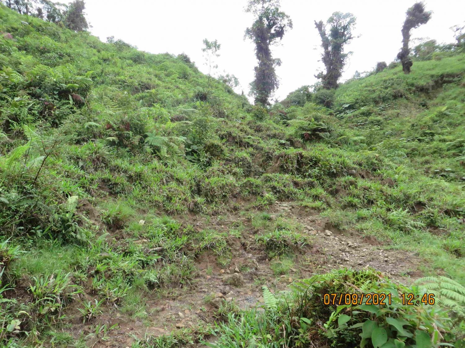
After that, we came to the entrance to the jungle:

While hiking to the Mirador, we quickly learned that it’s difficult to go off of the trail. The trail is straightforward. There’s only one trail split, but that split happens far before reaching the Mirador. Here is the trail split:
Therefore, considering the timeline of Kris and Lisanne’s Mirador photos, it’s clear they did not take the wrong direction at that trail split. They couldn’t have taken the wrong path and also arrived at the Mirador.
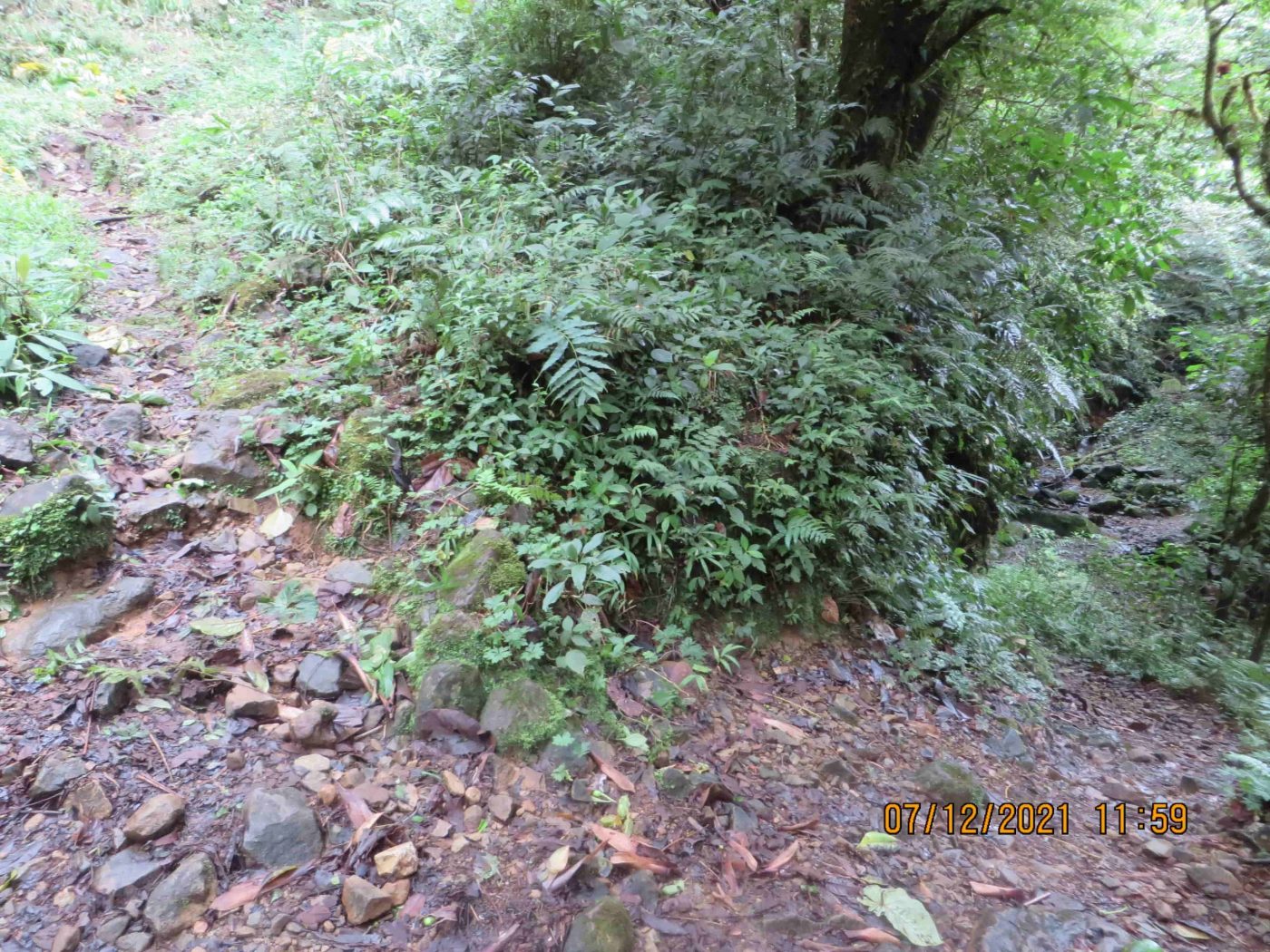
When we first planned our expedition, we wanted to map the “trails” (plural) in the region. We originally thought there was more than one trail. But during the actual hike, we learned that there’s just one trail Kris and Lisanne could have taken, especially with consideration that their daytime photos from April 1st indicated they made it to the Mirador. The Pianista Trail is surrounded by heavy vegetation and the trail itself is often carved deeply into the mountainside, limiting any opportunity to go in a different direction.

Occasionally, the trail is on the edge of steep cliff-like slopes, with trees and vegetation below. The slope is not similar to rock-cliffs as one might imagine, but certainly it’s too steep to risk going off-trail.
Here’s a good example of the limiting factors that make it difficult to go anywhere except for on the trail:
In the photo above, notice how difficult it would be to go off the trail. On the left, you’d be facing a steep incline that’s heavy with vegetation. On the left you’d be facing a steep slope that’s equally covered in vegetation.
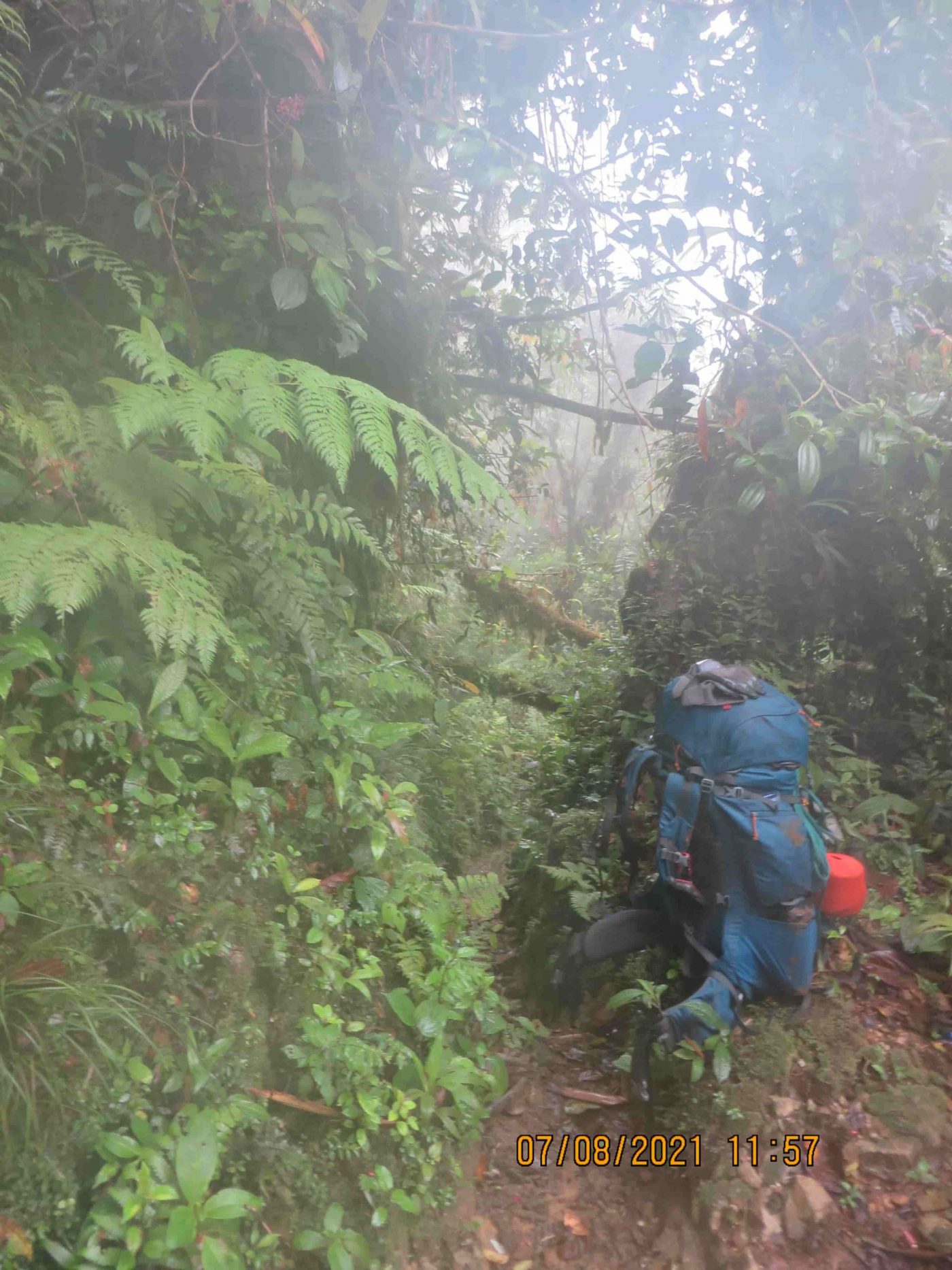
During the hike, Romain almost slipped and fell off the edge of the trail, mainly due to the weight of his backpack shifting as he lost traction on the ground and slipped. Romain was climbing El Pianista with a 25 kg (55 lb) backpack and started to lose his balance next to the edge of the trail. At this particular point on the trail, if he fell he would have fallen approximately 10 to 20 meters down.
As the gear in his backpack shifted, Romain managed to grab the ground and stay within the edge of the trail. It was a small scare, but it demonstrated to us that even with all our gear it’s still not difficult to avoid slipping off the edge of the trail, especially due to all the vegetation that’s available to grab onto. Keep in mind, Kris and Lisanne had a very light backpack with them, with only a handful of items inside of it. Therefore they likely would have a lower risk of falling than our team.
Exp #1: El Pianista Trail Conditions
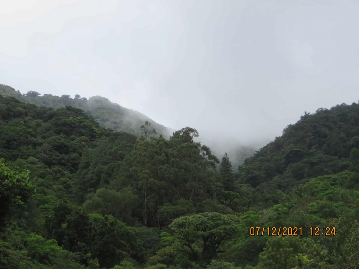
We experienced very little rain during both expeditions. Only during two nights did we receive a very light sprinkle, and some days, few times during the afternoon. As mentioned before, July and August do not receive the heavy rains that arrive later in September. Although not exactly the same, we were in similar climate conditions that Kris and Lisanne would have experienced during their hike. There was certainly more moisture in the air. In addition, the density of the vegetation was quite similar to the one we can see on the pictures of the girls.
Occasionally we came across heavy patches of mud, especially in high-elevation flat areas where standing excess water couldn’t drain.
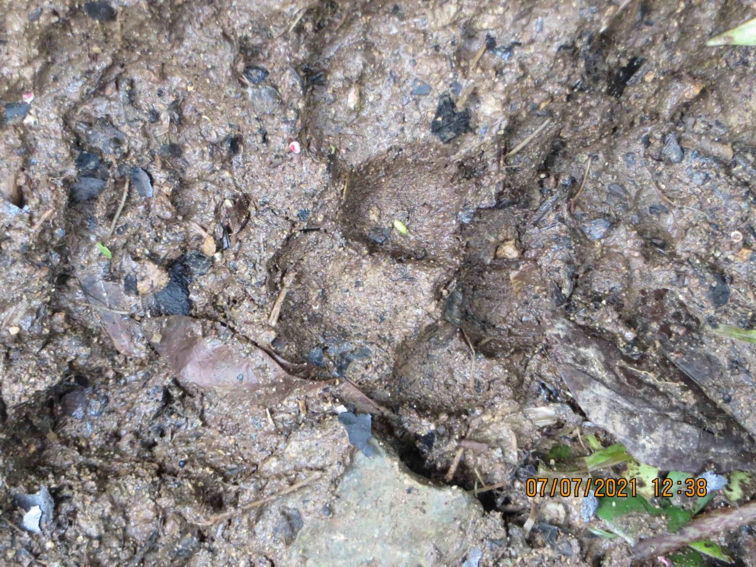
We also found traces of wildlife during our hike. At one point Yann pointed out the tracks of what he said were potentially from a small to mid-size feline animal.
Exp #1: Mirador Observations
The location of the Mirador itself was obvious once we had arrived. Quickly we recognized the imagery from the photos that Kris and Lisanne had taken when they were at the Mirador.
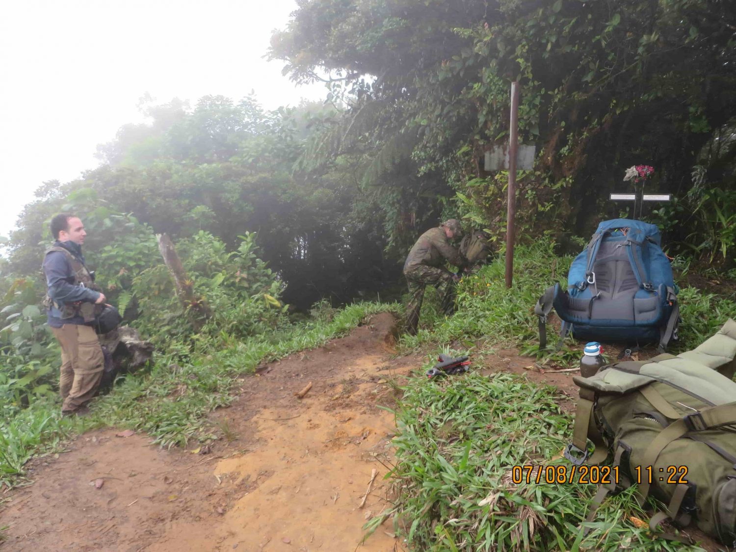
The vegetation and landscape at the Mirador had changed somewhat from Kris and Lisanne’s took their photos in 2014, but we were able to see numerous similarities. Also, we saw the memorial placed at the Mirador in memory of Kris Kremers and Lisanne Froon.
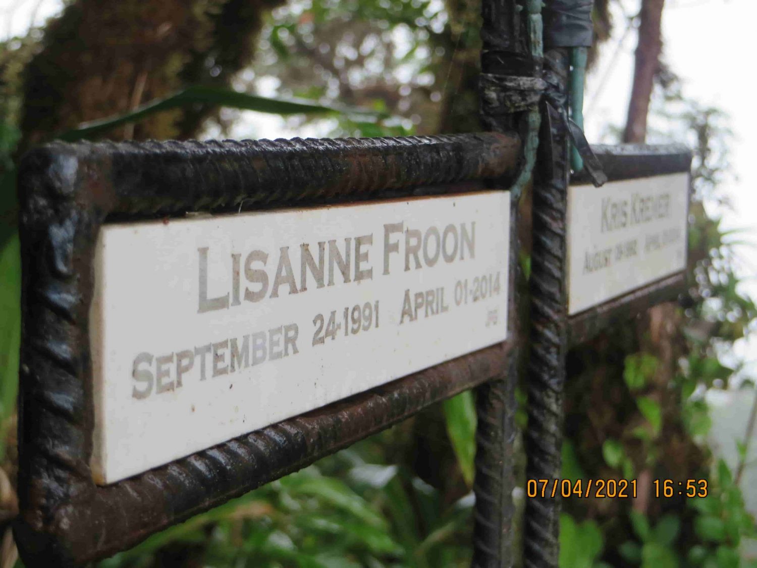
Being at the Mirador was somewhat of a bittersweet feeling. We were content with our achievement to arrive at the Mirador, but we also reflected on the fact that two people lost their lives down the path from where we were currently standing. We knew we had come to the Mirador for that exact reason – in search of more answers.
The Pianista Trail before and after the Mirador have distinct differences. It would not have been possible for Kris and Lisanne to accidentally go in the wrong direction. The positioning of the vegetation, the view of the other mountains, and the manner in which the landscape is positioned at the Mirador are all very clear indicators of which direction a person is facing. Also, the town of Alto Boquete (“High Boquete”) is visible from the Mirador on one side the mountain range, while on the other side of the Mirador there is only green forests visible for as far as the eye can see. Therefore, from these numerous factors, Kris and Lisanne would have been aware that they had passed the Mirador in their subsequent photos, such as in photo #507 and #508.
Furthermore, the trail beyond the summit continues in the same direction north for several hours. After hiking north for a while, it’s unlikely that a hiker would assume that the trail would eventually lead back to Boquete. The surroundings and conditions change further down the northern-facing slope of the mountain; those conditions contrasted with the surroundings on the southern-facing slope of the mountain ensure that there’s no doubt that you’re entering a totally different region.
Any speculation about Kris and Lisanne having unknowingly chosen the wrong direction at the Mirador can be put to rest. They had intentionally opted to go beyond the Mirador.
To this day, nobody knows the reason they made that decision.
Exp #1: First Camp Site
After resting for some time at the Mirador, we knew we needed to find the location where we would setup our first campsite. We were new to the area and delaying the process could mean setting up our camp in the dark, which could pose some threats to our safety. Venomous nocturnal snakes and spiders are present, as well as colonies of fire ants. We needed to be cautious.
To complicate things further, we didn’t know if we would be able to find a place to camp at some point soon after the Mirador. So we decided to backtrack and set up camp slightly before the Mirador.
We learned quickly that it’s very difficult to find a good place to camp on this mountain. The steep slope surrounding the trail makes it very difficult to find any relatively flat areas to setup a camp site.
Yann, our expert jungle guide, found a good place for us to setup our camp for the night.
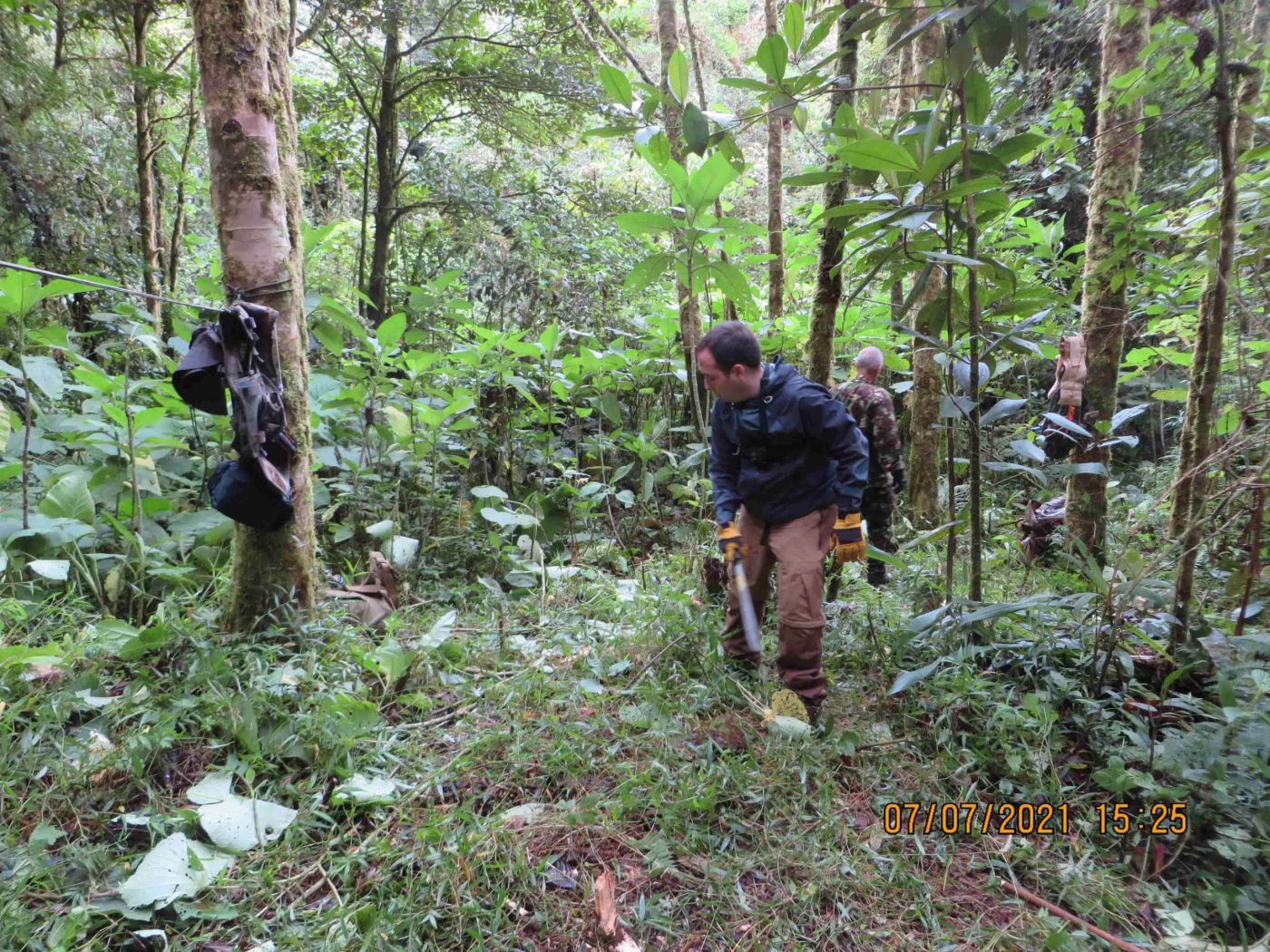
Camping in these conditions requires a lot of patience and mindfulness. We used our machetes to chop an opening for our hammocks. We tested the trees to ensure they wouldn’t fall on us while we were sleeping. We did our best to clear the area of brush to prevent insects from creeping into our sleeping space. Each decision was methodical. It took a lot of work to setup the campsite.
The following morning, we re-packed our gear and continued our hike.
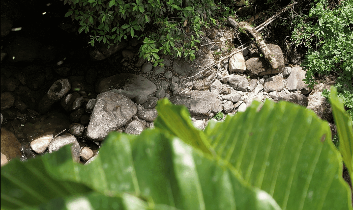
Exp #1: River 1 & 2
Shortly after the Mirador we found two small rivers, which we mapped using the GPS coordinates. Below are photos of each river.
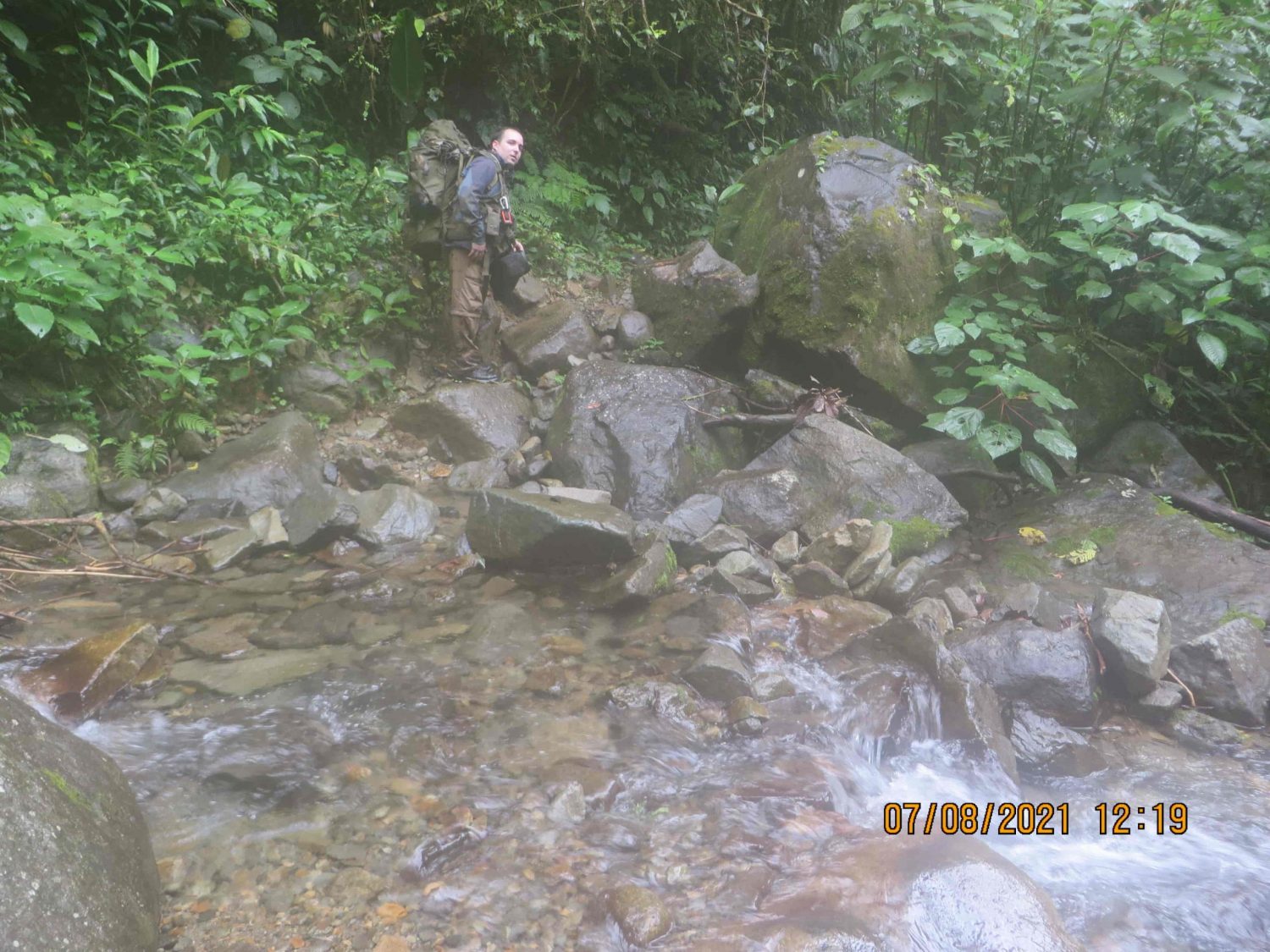
We took numerous photos of both River 1 and River 2. Afterwards, we continued our hike.
Exp #1: Noting A Mountain & An Important River (River 3)
We continued our hike on the trail after gathering photos and data at River 1 and 2. Soon we arrived at a smaller mountain that laid between the two rivers.
This mountain was worth noting on our hike for a couple of reasons. First, it was the first real barrier after the Mirador. Most of the hike down the northern-facing slope of the mountain, after the mirador, was relatively easy to hike down. But this small mountain was an inconvenience, especially after previously hiking up to the mirador.
Kris and Lisanne would have experienced this same hike, which suggests that this small mountain may have slowed Kris and Lisanne during their hike. Furthermore, this small mountain was exposed and without overhead vegetation. During the sunny days that Kris and Lisanne hiked on the trail, they would have felt more hot and therefore probably consumed more water than expected. This brings us to our next big find, the river, which we refer to as River 3.
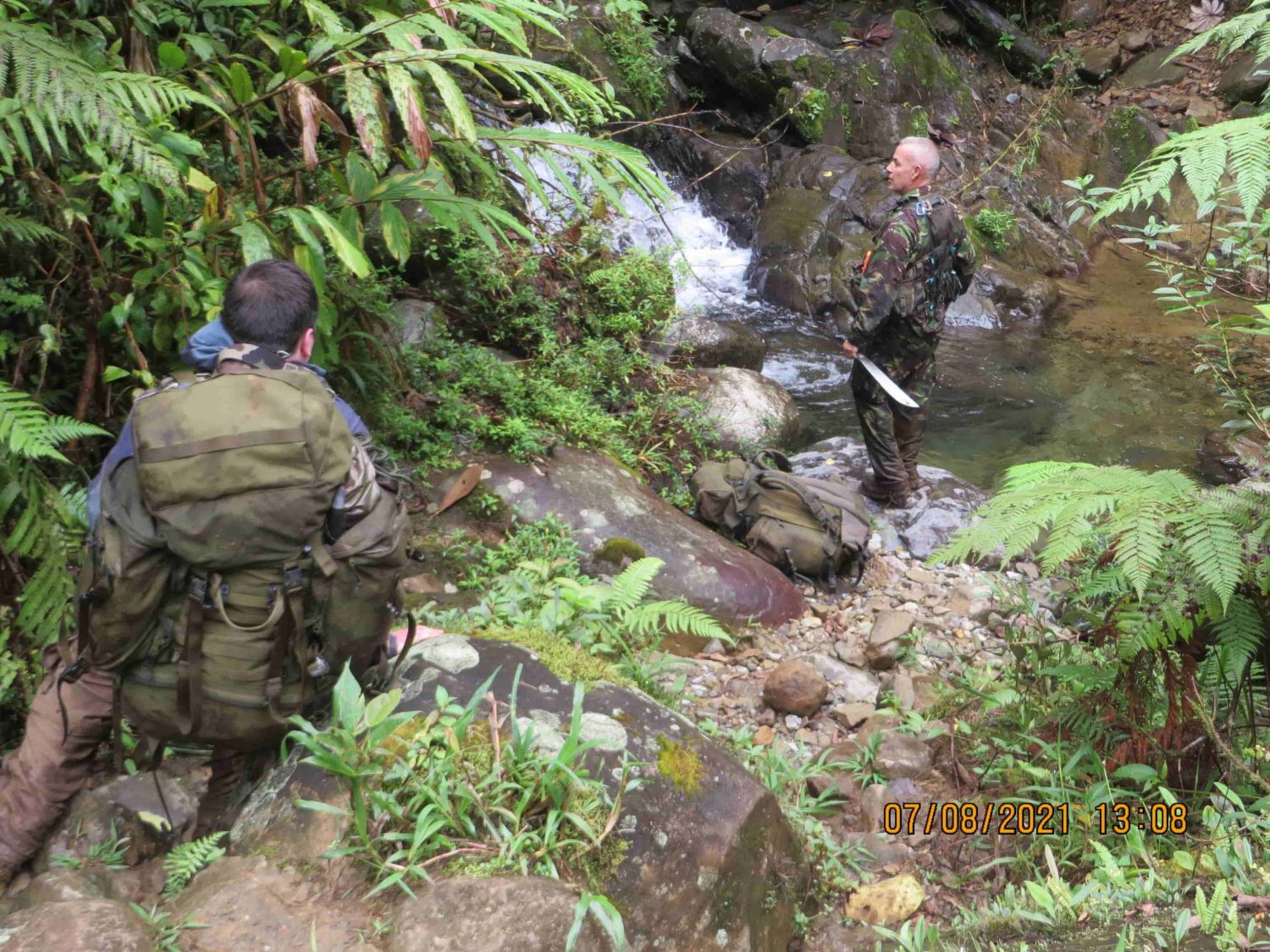
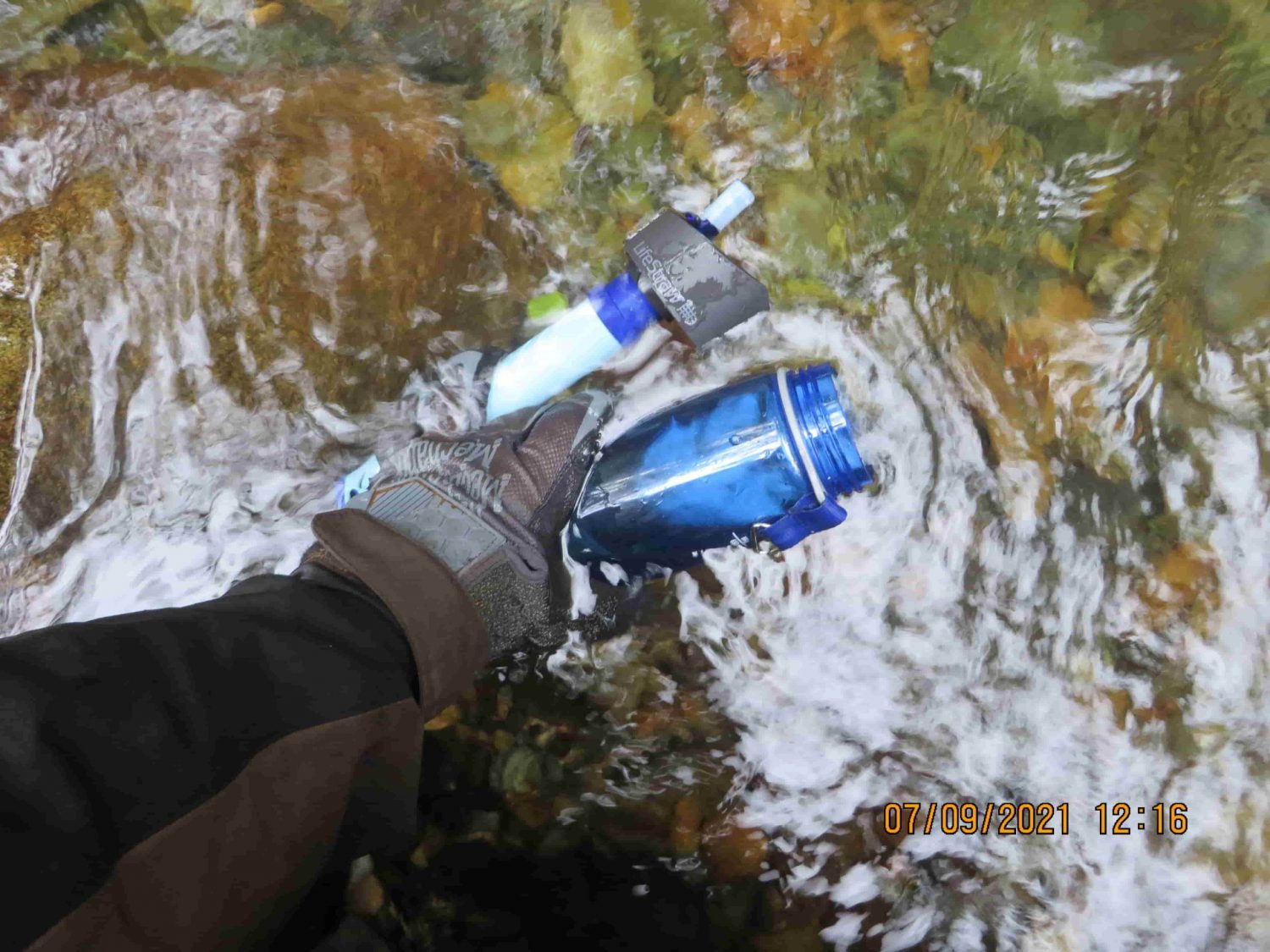
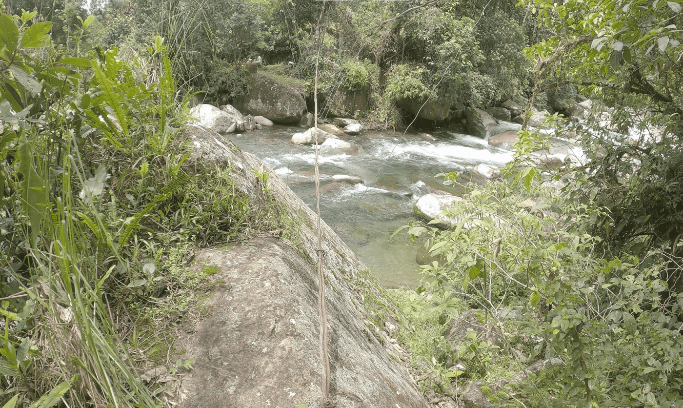
This river was an important find. It was a good source for drinking water, it had swimming holes with crystal-clear water, the temperature of the water was very cool and comfortable, and it had a lot of rocks at waist-level which made it perfect to sit and relax.
We’ll discuss this river more in a moment. After relaxing for a few minutes, we continued on the trail in search for our second camp site.
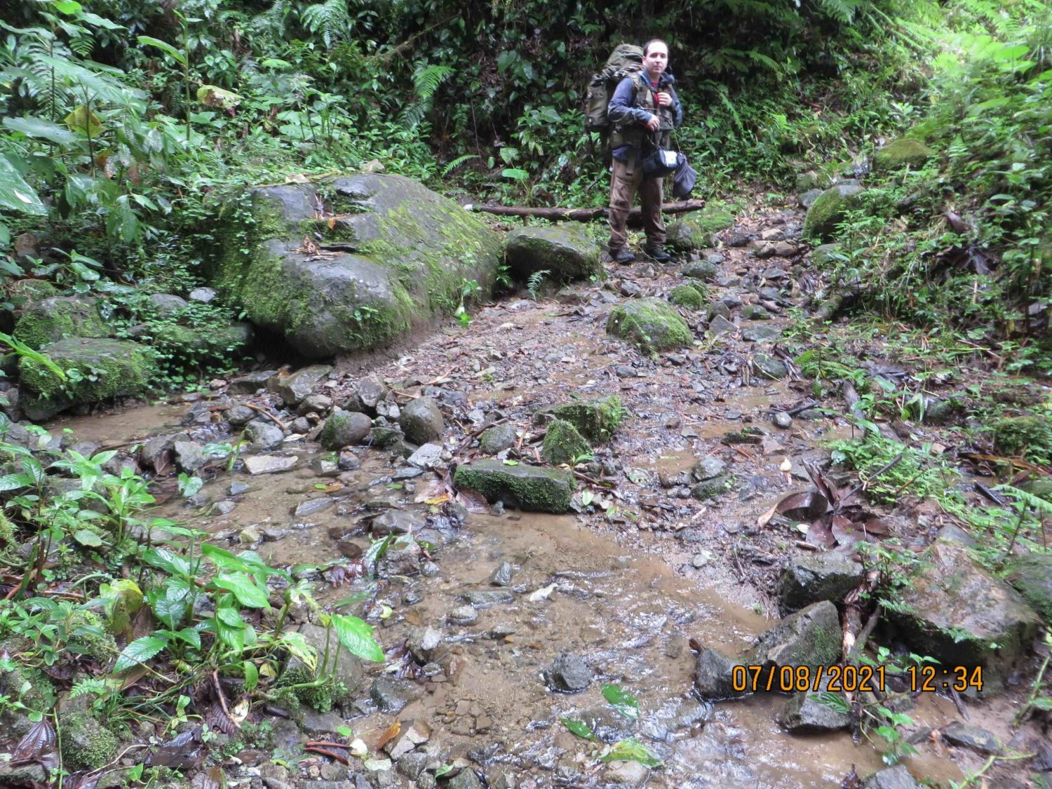
Exp #1: Second Camp Site
We continued hiking approximately 5 minutes beyond River 3 and found our second campsite location. We wanted to be near River 3 if possible, because it was the only nearby water source and we knew we wanted to investigate the river more. So our second camp site was in the perfect location.
In reality, the conditions at the second camp site weren’t optimal, but it worked for us and it would end-up being where we would call home for the next 4 days. The spider holes, nest of red ants and large amounts of dead branches hanging overhead suggested that it might not be the safest place to camp, but we organized our camp in a way that was reasonably safe and rid of potential dangers.
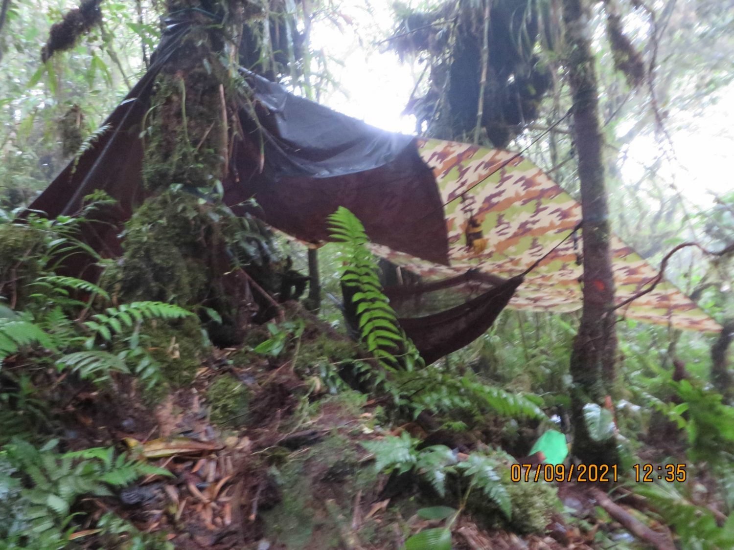
This camping site was loaded with spiders. We saw 4 to 5 inch spiders frequently, especially after the sun went down. Here’s a pic of one. Luckily we had mosquito nets covering our hammocks which protected us at night.
We saw numerous locals hiking the trail on a daily basis. We monitored the foot traffic in the area and kept notes of the number of people that past our camp. Approximately 5-7 locals passed our camp each day, usually around 2:00PM.
Exp #1: Hike Down River 3
After we setup our second campsite, we decided collectively to put some time into this river over the following days.
River 3 stood out to us for a few reasons.
First, this river is larger in size compared to the other rivers in either direction on the trail. Note, for the sake of clarity – this river is not large, it’s simply larger than the other rivers within at least a 30 minute walk in either direction.
Second, this river was like an oasis to us and certainly would have caught the eye of Kris and Lisanne too. Simply put, it’s a beautiful river. Unlike the other rivers in the immediate area, it was reasonably deep at some points which made this river the perfect place to sit and cool off during a long hike, especially for Kris and Lisanne during the sunny days early April.
Third, the water is crystal clear, drinkable and safe. This river was our primary water source during most of Expedition 1. Although the water temperature was chilly, it was refreshing for swimming.
Fourth, this river seem to fit the story of the disappearance very well. This river, and this river alone would have been a center-point of attraction after a long hike, for many reasons:
- It’s the only place that a person could walk off-trail comfortably to take a break. The river is wide enough and flat enough that a person can walk down the river without being engulfed in vegetation.
- There are many large rocks that allow a person to sit and hang their feet in the water.
- It’s the only river that a person can swim to cool off. All other nearby rivers on the trail were too small to swim.
- It’s a louder river than the other rivers nearby, due to its size. Therefore hikers can hear the river from a distance.
This river, to us, seemed to be the furthest logical point that a person would have comfortably hiked on this trail before turning around and going back to Boquete. Immediately beyond this river is a steep incline that must be climbed to continue on the trail. Although we hiked that steep incline numerous times (to get to our second camp location) a normal hiker would likely not have opted to do so unless they had a good reason to do so.
If Kris and Lisanne decided to travel further on the trail than this river, it begs one to ask…why? This river would be the perfect place to cool off, refill the water-bottles and turn around to hike back to Boquete.
As mentioned before, this river fits the story well. Two girls go hiking, decide to cool down before hiking back and then something unexpected causes them to flee the area by running down the river and they experience injuries.
We hiked up and down this river more than once.
We collected ample information from River 3, including most of the environmental information that we gathered. We also took a significant amount of photos, videos and drone footage of the immediate area. We’ll publish another article specifically about this river.
During the river hike, Chris experience a slip and fall accident and banged up his shin a bit on the rocks. Fortunately, it was nothing serious, but we applied basic medical preparations to ensure it didn’t get infected.

Shin injury from falling on rocks 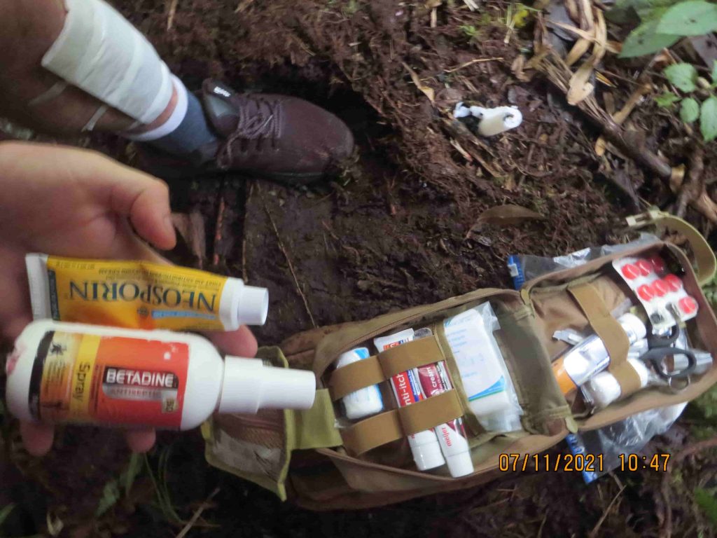
Cleaning up the injury
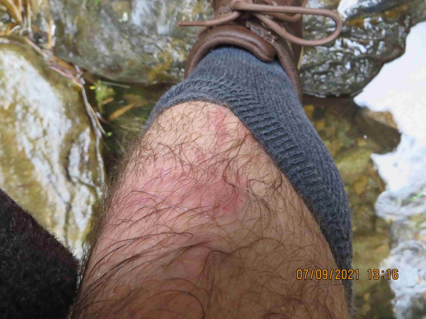

Here’s a photo of the injury a couple of days after the incident.
Expedition #1: Environmental Data
We gathered a handful of pieces of environmental data. The river temperature was 16.5 Celsius and the air temperature was ranged between 16.8 Celsius to 17.5 Celsius, depending on the amount of sunshine.
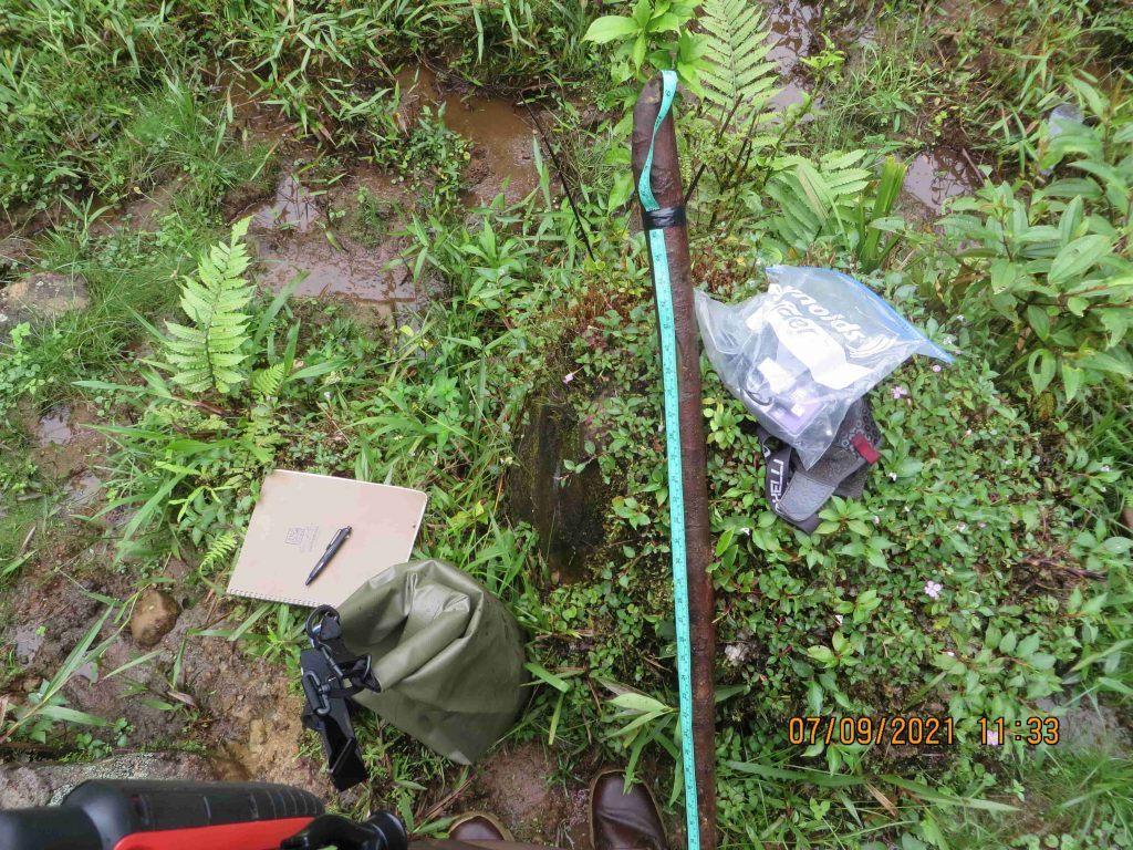
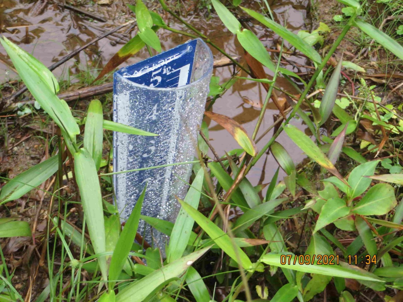
Data gathering 
Rain guage

Here’s a list of the specific environmental data we gathered:
- Amount of rainfall during our first expedition.
- River height/width before and after rainfall.
- River temperatures during the day
- River temperatures during the night
- Air temperatures during the day
- Air temperatures during the night
This information may help provide us with some important insights and give us a reference to compare against the limited publicly available data. In the article “Kris Kremers Bleached Bones – Deeper Insights” I provide many examples for why this information could be important. At the very least, this precise information has never been collected before and now it will be publicly available for anyone interested.
The environmental data will be published in detail in another article, with some further analysis discussing it’s relevance to the case.
Exp #1: Recreating The Night Photos
We did our best to take night photos under similar circumstances that Kris and Lisanne would have taken them.
Note: These photos were not taken at the real night photo location. These photos were taken at a different location.
It’s far too dangerous to go hiking through the rivers at night.
You can see a handful of the night photos we took below:
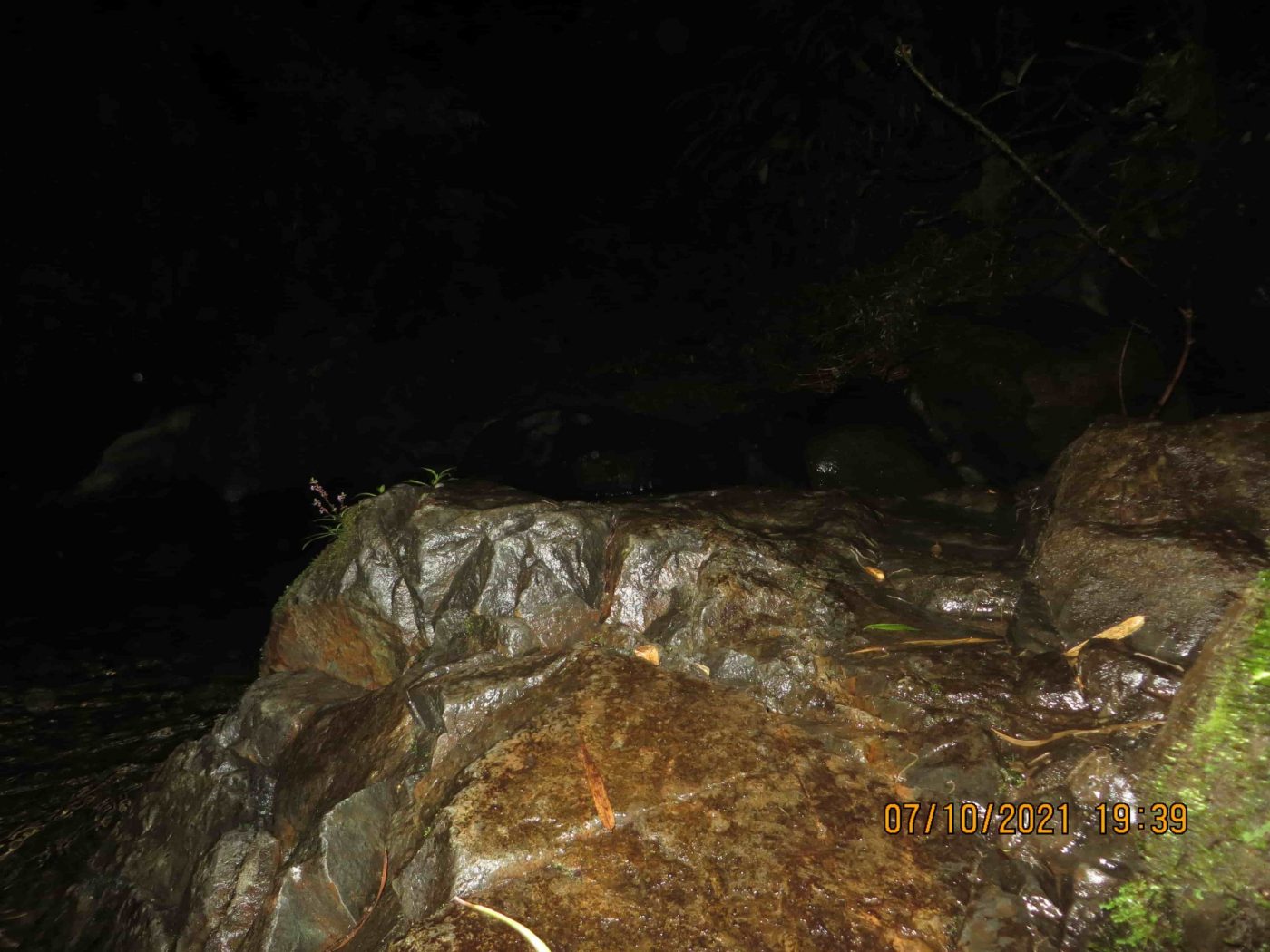
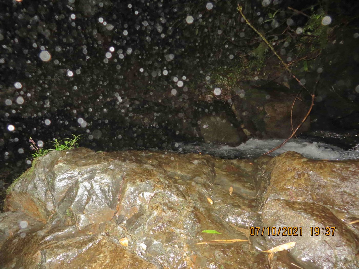
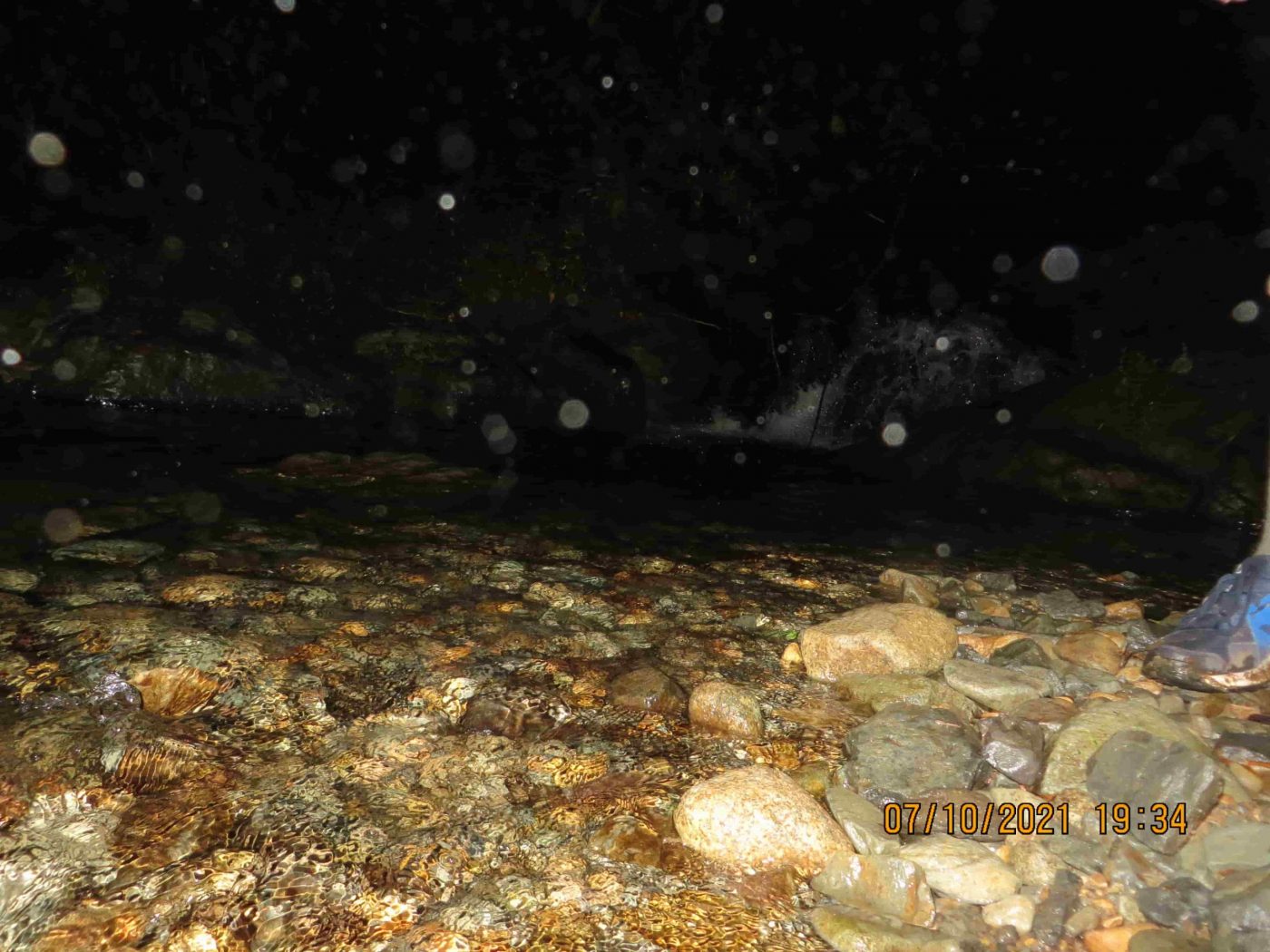
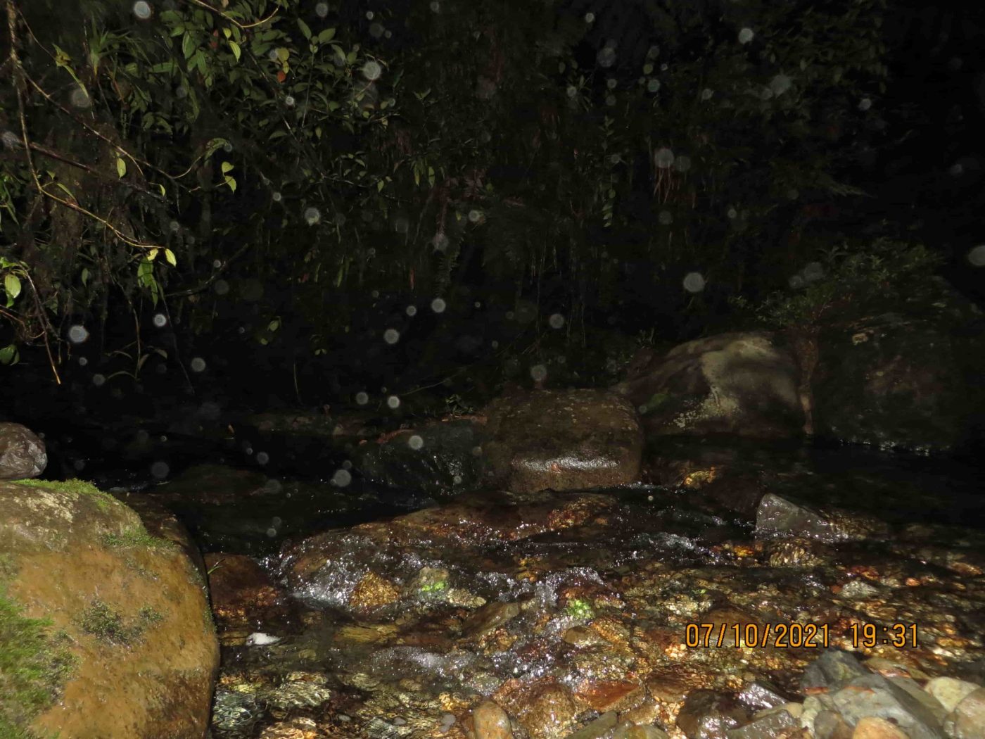
These photos were taken where the trail meets River 3, with the Canon Powershot, the same camera that captured the “night photos” in Lisanne Froon’s camera after Kris and Lisanne disappeared. We took these photos at approximately 7:30PM.
We took photos from numerous angles of the rocks, the trees and the river itself. We’ll be writing a separate article to discuss these photos in detail, with comparisons to the night-photos that were found in Lisanne’s camera.
Exp #1: Visiting The Paddock
On the northern-facing slope of the mountain, the trail decreased in elevation until we came to the open space commonly called the Paddock.
While Chris was hiking through River 3, Romain and Yann took some time to visit the Paddock. At the paddock the jungle opens up into clear space with significantly less trees and vegetation.
Romain took some fantastic drone footage of the Paddock:
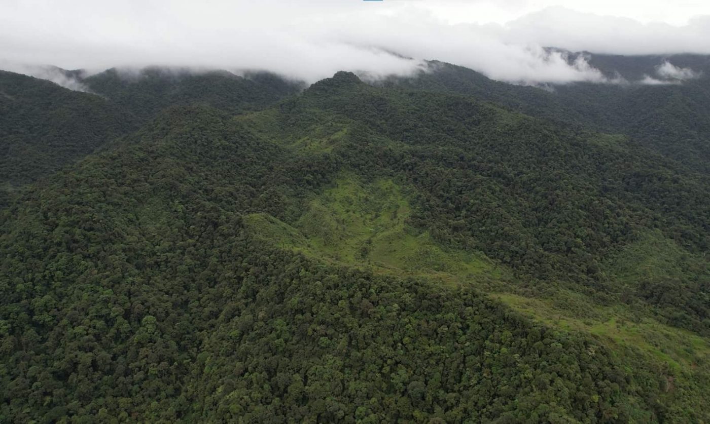
Although many people imagine the paddock to be open pastures of flat area, it’s actually very mountainous, with steep inclines and declines. The terrain in and around the paddock is not flat, as most people assume. It’s not as easy of a hike as the initial hike on the Pianista Trail.
There are no visible houses or cabins near the Paddock, which suggests that Kris and Lisanne wouldn’t have found refuge if they desperately needed to find shelter.
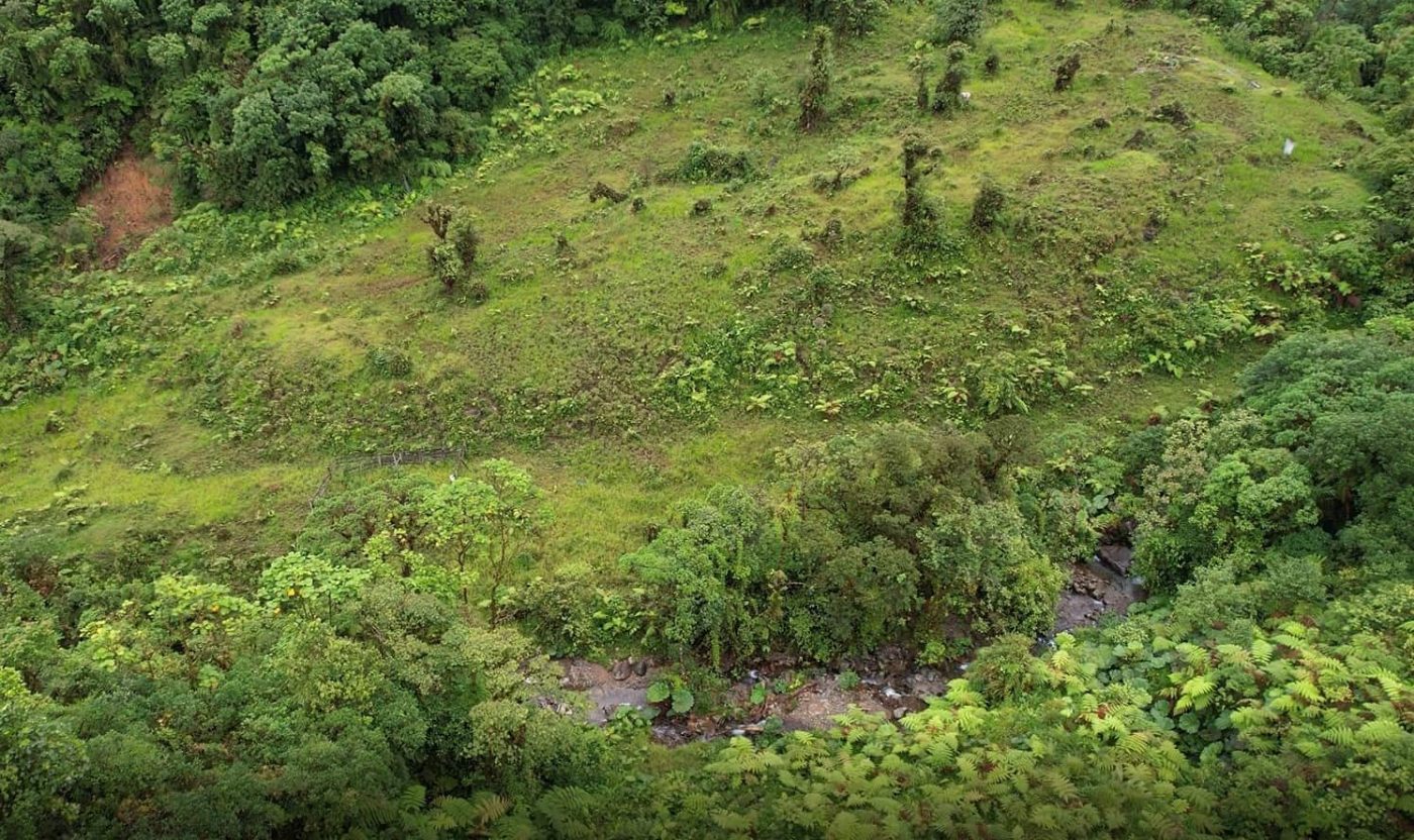
The paddock is utilized by local farmers for livestock and fences are present in the area. Additionally, behind the Paddock there is a destroyed cabin, which is not visible in the photo above. The drone footage will be published at a later date.
That was the duration of Expedition 1. Once our objectives were complete, we hiked back to the Mirador and continued on the trail to return to Boquete.
Expedition #2 Overview
Duration: 3 Days, One-Way, Returned By Bus (Norteno, North-East of Alto Romero)
Date Started: August 18, 2021
Date Completed: August 20, 2021
Focus: Monkey Bridges, Alto Romero, Laureano’s Farm
Team: Romain. Accompanied by Plinio and Laureano.
The goal of Expedition 2 was to cover the Pianista Trail in its entirety while also continuing on the trail to visit other key locations, such as the Monkey Bridges.
Exp #2: El Pianista To The Paddock
The first thing the team noted while hiking on the Pianista Trail to the first Monkey Bridge, was that there was only one visible trail that spans the entire distance. This is the same trail that the locals use and there are no alternative trails that lead to the Monkey Bridge from the Mirador. Occasionally the main trail briefly splits, with smaller trails breaking-off of the main trail for about 5 to 20 meters, but they always merged back onto the main trail.
The level of difficulty of walking the trail greatly varies from one section of the trail to the next. For example, between the Mirador to the location of River 2, it is fairly easy to walk on the trail. Even though the path is often narrow and there are a lot of rocky areas to pass, our team still managed to hike comfortably at a moderate pace.
After River 1 and River 2, the level of difficulty of hiking the trail increases.
As mentioned during Expedition #1, as we approached the mountain between River 2 and River 3, we began climbing again in elevation. However, the real challenge for us was the terrain because of the mud and unlevel ground.
Exp #2: The Paddock & The First Monkey Bridge
As we went beyond the Paddock, approximately 30 to 40 minutes beyond River 2, the trail became even more muddy and difficult to pass. Not only did the team get tired more easily but we also faced very slippery areas.
These conditions weren’t dangerous but it took a lot of our energy and slowed us down.
As mentioned above during the first expedition, there aren’t many areas along the trail where you could fall. Falling down the slope certainly could result in injury, but in most cases the vegetation is dense enough to slow you down and could potentially help you to climb back up to the trail.
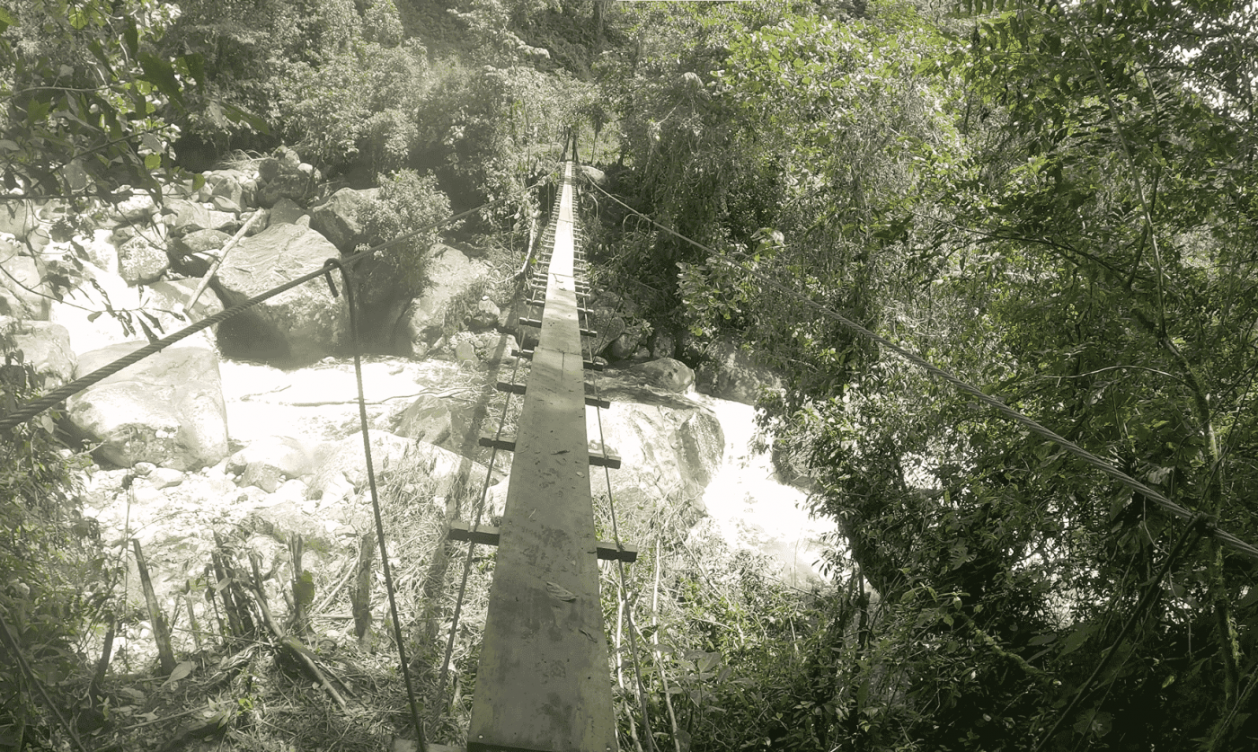
After hiking for some time beyond the Paddock, we eventually arrived at the first Monkey Bridge.
On the north side of the first Monkey Bridge the winds are much stronger and it is very difficult to safely fly a drone. The wind present is powerful enough to push the drone against the trees, and as a consequence, we almost lost a drone while flying over the first Monkey Bridge.
North of the first Monkey Bridge, the wind is a strong enough threat that helicopter pilots typically avoid flying their aircraft over the mountains in that region. There’s an increased risk of a crash taking place under these conditions. However, helicopters can fly to areas located to the north-east and south of the first Monkey Bridges.
Exp #2: The current state of the Monkey Bridges
During early August of 2021, the first and the second Monkey Bridges were renovated by Plinio and Laureano, whom covered the costs of building the bridges by themselves. These bridges are still made of cables, however the new renovations involved adding wooden planks to stabilize the bridges and make them safer to cross. In 2020, an unfortunate situation happened where a mother and her two children fell while crossing a Monkey Bridge during a storm and died.
The third and fourth Monkey Bridges are still cable bridges but there’s already plans that they will be renovated in the future. These cable bridges (the third and fourth), even though being scary to cross, are not difficult to cross. They can withstand fairly heavy loads, such as up to two people at the same time. However, even with the strength of the cables, it is not safe for two people to cross the bridge at the same time because each person has to be very careful with their balance and movements. With each step that a person takes, the cables are typically swaying back and forth under pressure. Attempting to cross the bridge with another person is more challenging and therefore more dangerous.
Exp #2: Going to Alto Romero
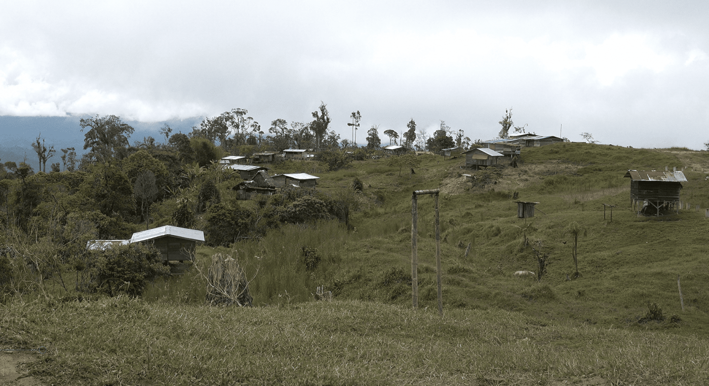
The trail continues to Alto Romero. As we approached Alto Romero, we observed a few small cabins from a distance, which suggested that there were many small trails that broke off from the main trail. Invisible to anyone unfamiliar with the area, these trails are known to locals but are otherwise difficult to spot. Romain was given a map during his stay in Panama, which was originally drawn in 2014. This map illustrated the location of these hidden trails and some cabins which are not visible from the trail or from satellite images.
It took 2 days (16 hours) for Romain to reach the Alto Romero community. However, a native to the area can do the walk in only one day and can even reach the area of Picture 508 in ~5 hours.
Exp #2: Phone coverage
At the Mirador, it’s possible to establish a cellular connection due to the high elevation and the proximity to Boquete, which has numerous cellular towers. Phone connectivity isn’t available in the area beyond the Mirador, on the northern-facing slope of the mountain, including in the area surrounding the Monkey Bridges. Therefore you won’t have success connecting to any services regardless of whether or not you are in an open area. As everyone knows, being in the middle of nowhere and surrounded by hills and vegetation, it’s obviously less likely to get a connection.
In Alto Romero, you can make phone calls because the connection is fairly strong. At some areas outside of Alto Romero, you can sometimes pick up a signal. For example, at Laureano’s farm it’s sometimes possible to send a text message if the signal strength is strong enough. Alto Romero is much closer to national roads and developed towns, which are located slightly east.
The mountainous area where Kris Kremers and Lisanne Froon disappeared is a considerable hike from Alto Romero. That mountainous area mostly goes uninhabited because the conditions are unaccommodating in multiple ways. The mountain and the trail serve locals as a path to travel to Boquete, or to their cabins, for work or trade.
Day Trip: Swimming Photo Location
Before discussing this subject, it’s important to mention that there’s no evidence proving that the swimming photo is related to the disappearance case of Kris Kremers and Lisanne Froon. However, enough speculation and connecting many pieces of the case together has left a lot of people wondering about the swimming photo and it’s possible relation to the case. I’m not going to go much further into the subject in this article, but there’s plenty of information about it on Scarlett’s blog.
Our team decided to try to find the swimming photo location to learn more about the area. It took basically the entire day to find the precise location.
Main river entrance upstream 
Road leading down to the river. 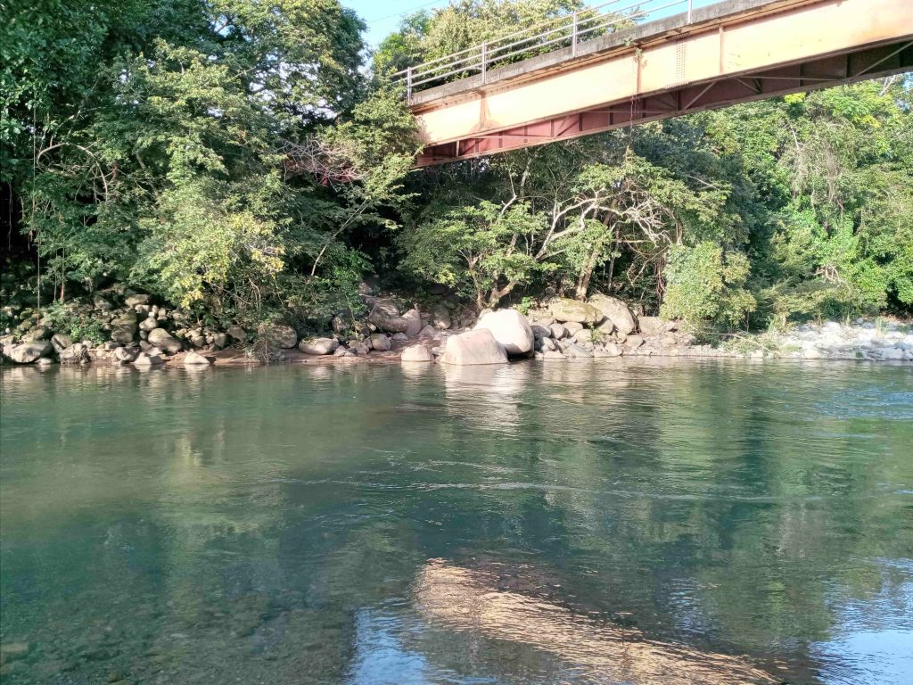
Zoomed out 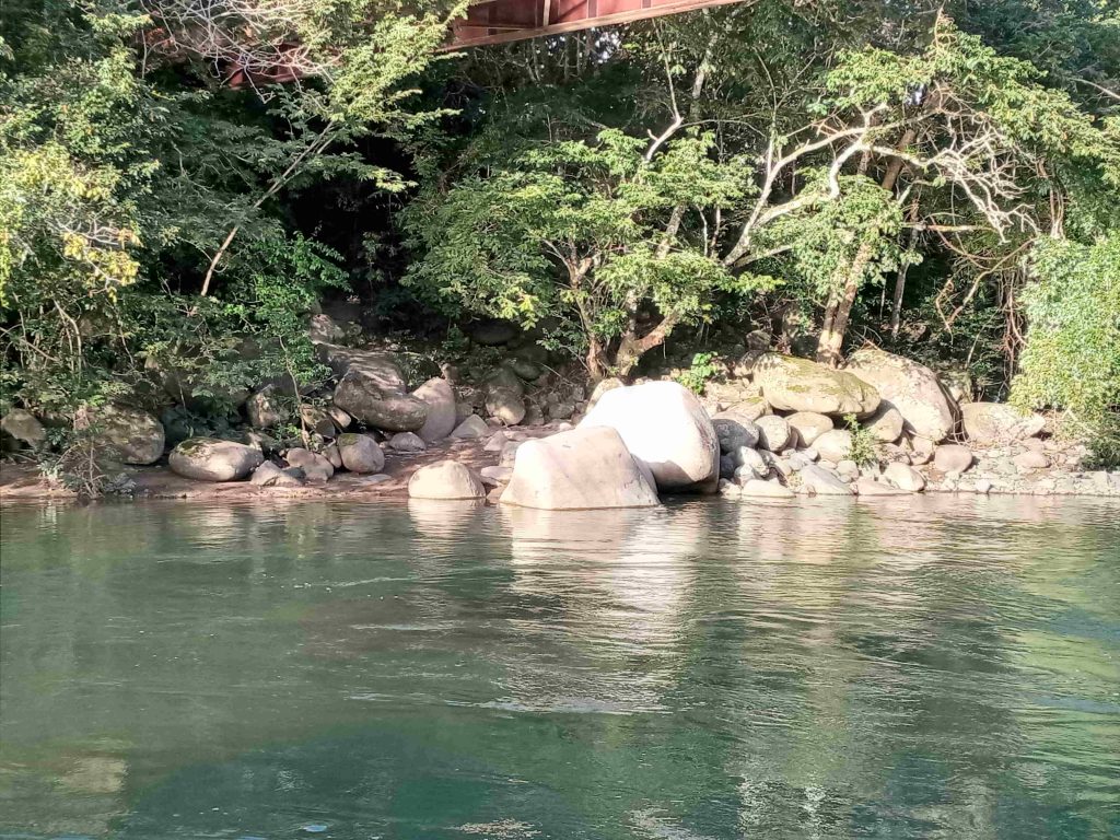
Zoomed in


GPS Coordinates: 8.69150, -82.30244
We also did some metal detecting in the river at the Swimming Photo location and the surrounding area to see if any artifacts could be found. Unfortunately, the river is fairly fast moving, which would sweep anything away. On the shores, we searched and only found bottle-caps and similar objects.
Altogether, the drive to get to the swimming location was much more than we had expected. Altogether it took about 40 to 50 minutes to drive there from Boquete. This area is nowhere near Boquete and would be a big inconvenience for any travelers to visit. And it’s likely that only locals would know about it. We drove down a long poorly-paved windy road to get to this place.
Upcoming Articles
As mentioned before, we have more articles coming that will discuss a lot of these findings in further detail, with more data and more analysis. We’ll be discussing the location of Photo 508 in further detail in a future article as well. Romain is working with the vast amount of video footage we gathered to prepare some videos to publish. Once those videos are published, we’ll provide links to the videos on ImperfectPlan.com.
We’re thrilled to have had the opportunity to visit Panama and collect all of this information. Organizing all of the photos, videos and data has been an enormous project within itself and we’ve still got a lot of work ahead of us.
Thank You To Our Followers & Supporters!
We’d like to thank all of our readers, followers and contributors for their support and patience while we collected and organized all of this information. It’s been an incredible journey and we’re not finished yet.
Thank you again.
It is heartwarming to see to which lengths you go to try and clear things up in a really sad case. Really great job, and thank you for all you do and have done.
What is the time of travel from the location of the last day picture 508 to the monkey bridges?
If you put a point on the map, at the spot of the final normal photograph of Kremers, crossing the stream, and draw a circle around it for the distance that could be traveled in any direction up to the time of the first emergency phone call, whatever route that can be traveled inside that circle must be the place of the emergency if the data is genuine. If there is no possibility of being lost, or having a fall inside that circle, then there must have been foul play. Is that not correct? What is in that circle? Is there any explanation inside that circle, except being chased deeper towards cable bridges?
@Ralf; please watch this video of the trail between the Mirador and River 3.
https://youtu.be/sqIW0LTodgI
Just a couple of minutes beyond spot #508 / River 1, there is a barbed wire fence.
And immediately after crossing River 3, there is a gate.
This is not “no-mans” land. People come here otherwise there would be no need of placing fences and gates.
As Chris and team have described there is only one trail and there aren’t any side trails (at least, not in that specific area). Chris has also described that 5-7 locals passed by every day while they were camping.
In other words: SOMEONE must have seen the girls walking on the trail behind the Mirador. But that someone has kept quiet.
If Kris and Lisanne had decided to go off trail, they must have done so because something or someone had scared them off.
They would not try to look for a short cut behind the divide. They were wearing shorts and their legs were not covered.
Although I understand what you are trying to say, it does not make sense to look for a short cut beyond the Mirador and beyond the Continental Divide. Just watch the images of the trail on YT. There’s not much possiblity for looking for a short cut in that area.
Were you and your group wearing long pants when hiking in Canada?
Hi Thumbs Up, that’s incredibly helpful footage. Viewing the trail from the hiker perspective such as you have is showing just how beautiful the jungle and that area is and I can see the lure to keep hiking as they initially did on that day.
It’s also showing though how extremely rough and challenging the terrain is. I am a very experienced intrepid hiker and there is no way that I would go off a trail like that for any random reason in that kind of environment and nor would anyone that I know. Lisanne was an experienced adventurer so nor would someone of her training. If I did have to go off a trail like that I would
meticulously take note so that I could find my way back to the main trail and either continue further on the trail or head back.
I can see that Lisanne was a very detail oriented person by her photography, by other aspects of her documentation and by references her family have made regarding her character and her extreme outdoor experience and it is simply unbelievable to me that she would risk taking herself and Kris off trail for any other reason than very serious danger. No one with experience would take that kind of risk unless there was no choice.
I don’t think the question is why did they continue hiking – it’s a lovely day, two best friends on a stunning hiking trail albeit a challenge but it was obviously fun to start with. Plus I think they may possibly have thought the trail looped back to Boquete at first.
I think the question is why did they go off the trail and then not return to the trail to go back to Boquete. They did not go off the trail on a whim because there are no smaller trails off the main trail and anyone can see it was too rough to go off the main walking track and even if they had they had the skills and the ability to back track to the main trail. It has to be that they went off trail due to a critical incident and were unable to return to that track due to safety and were trying to find another way back.
I wonder what exactly going on behind the barbed wire in such place?
To Unknown – I grew up on a farm. Barbed wire keeps in cattle or horses, etc..
I am not sure that picture 508 was taken at the same spot as of river 1. To me the places look too different, especially the big stones on the right are missing completely.
Well i hope your photos of the 2nd monkey bridge are better and numerous.
You did get plenty of drone footage and what not between 2nd and 3rd bridge?
They must have died somewhere near the river. Because the shorts were found in the river. So by that logic they must have died upstream from where shorts were found. I would recommend someone to go where the shorts were found and walk upstream and look for bones.
One thing thats very sus. Why did they stop using the iphone after 10 days? It still had 22 %.
If u have water, u can survive way longer than 10 days without food. And by all evidence(night photos, bone and shorts locations), they were near water. That’s very weird.
Possibly someone found them after 10 days and killed them.
I have done 30 days fasts with only water.
I think they though the trail was a loop. I think they may have argued after 508 about whether or not the trail was a loop. (Why there is no further pics) Then, when they made it to River 3, it was obviously not a loop, and they had to make a decision- turn around (at this point they know they won’t make it back before dark), keep going forward (further into the jungle) or maybe they made the fatal mistake of deciding to follow River 3… while hiking down River 3 they have a fatal accident or serious accident- eventually they die… this would explain why the search team didn’t find them on the trail.
To C
There is a photo at the site of an outdoor table with food on the table. Lisanne is studying a tourist map of the area and Il Pianista trail.
Surely she noted that there was no return loop to that hike.
What if they had a shattered pelvis or femur which would have led to sepsis or a fat embolism? Being near water isn’t going to save you if you are seriously injured.
i know people say the swimming photo is inconclusive, but red heads are fairly uncommon, plus from other photos of the two girls, the red headed female is shorter in height than the darker haired female. In the swimming picture, the red headed female is also shorter than the darker haired female. Red heads are very uncommon in South America, for example Argentina views them as “bad luck”. To me the red headed female really looks like Kris Kremers in the “swim” picture of where they’re in the water with the two males.
Good day, here is a late reply by online standards. Agree with you there is a reasonable probability they are the ones in the photo
Not on 1 Apr 2014 but possibly an earlier day.
Not just the physical resemblance but also the significant height difference. The girl on the right has to slant one side to ensure the water level reaches below the shoulder.
Meanwhile for the “redhead” girl on the left, the water level practically covers her shoulder, perhaps up to the neck, without for her to slant.
Perhaps not too difficult to find 2 girls with similar physical resemblance but big height difference? Not that easy.
Hi !
Thank you for your work and the effort you put into it!
One suggestion: Please make your own YouTube videos. Your information is already being used by Youtubers for their videos. You do the work here. Don’t let this be stolen from you.
Most Europeans do not know what desert or jungle means.
You can’t get lost here in Western Europe.
Even in the deepest forest you only have to walk straight ahead and after a few kilometers you will find a road or a village. It’s almost like Disneyland.
Why are there no more images after 508?
Well, in the early 90’s I was traveling with a group of 10 in Canada (Goosebay).
At that time, as young Western Europeans, we didn’t understand the concept of wilderness either.
To make a long story short:
We thought we could find a shortcut through the woods back to the vehicles…
Big mistake. It took us hours before we found out.
It was interesting: Although we had cameras with us, not a single photo from this multi-hour march exists. We were just too busy trying to find our way back.
The whole group had a military background and we were all trained to navigate the forest (at least in Europe…)
Nevertheless, there was some confusion / panic and wrong decisions. A very educational experience.
I don’t think they both understood that they were putting themselves in a life-threatening situation. I think they thought they were on a safe loop trail.
There is probably no goodbye message, because in that moment you admit that it’s over.
They must have had hope to the end.
In my opinion they went off the path shortly after 508.
As Kris’ father said, they would probably have taken more photos if they had followed the trail further. The fact that this didn’t happen tells me they were too busy at the time. (From own experience)
There is a case where a similar wrong decision was made:
https://en.wikipedia.org/wiki/Death_Valley_Germans
The case was then cleared up years later:
https://www.otherhand.org/home-page/search-and-rescue/the-hunt-for-the-death-valley-germans/i-concoct-a-theory/
What I think of the foul play theory: I lived on the Mexican border for years. The criminals (at least in Mexico) are pretty straightforward. There’s no need to set false tracks with photos and fake calls.
People just disappear. At the time the backpack was found, nobody was interested in the case anymore. No need to surface evidence.
Chris:
In what condition were the cell phones and the camera? I just find conflicting information. Did the devices have water damage or not?
Greetings from Germany, Ralf
What happened to the iPhone? iphones have features that only iPhone (Apple) can unlock. A 911 call was briefly connected then lost which means they were near the outer fringes of cell phone coverage.
I work as a detective in South America and i’m a hikking enthusiast and this case is in my mind since 2014, specially because i was in Panama sep/2014.
I could say a lot, but to prioritize objectivity i’m gonna go right to it. There’s a point that bothers me A LOT which I have never seen anyone talking about.
A few years ago I was on an island with one of those touristic maps that shows all attractions in some area. So I was on an old lighthouse and the map was showing a spot with an ww2 shipwreck. Since I was on a higher place, i thought i could see the area and proceed to walk towards it. When i reached the place, there was no shipwreck and i could not come back the same way since i’ve passed some big boulders. Long story short: what I thought to be a 2hrs hike turned out to be a 8hrs kind of lost experience. Later, talking to some guides, they said to me the map is completely wrong and the shipwreck is miles away from where I was.
Anyway, back to the case: as far as we know, the girls had a touristic map when they got lost.
https://1.bp.blogspot.com/-2cQko96ap30/XjSVyt7vudI/AAAAAAAABuE/pVkQU6dlIbkyaraUNH48ZIoVh-KZ69MtQCLcBGAsYHQ/s1600/IMG_0458_vs_IMG_nacht%2B%25282%2529.png
So I’ve always tried to get a copy of this map. Maybe it was done by the local government, maybe the hotel, maybe the restaurant… This map could be the cause of all that. It could show a nearby waterfall that wasn’t even remotely close to the area and this would be an initial explanation on why they reached El Mirador and then proceed further, because the map was showing something interesting that was “just right there”.
And why not coming back the same path? The same reason as me. They passed some big boulders, had a typical touristic bad decision of “of course we can do it” and could not come back. That also would explain why they decided to go (probably) downstream, because it’s a mountain area and going upstream (which was the direction to Boquete) meant to face big boulders. And of course they had hopes that at some point near the river they would find cattle and a house.
But they didn’t.
Renan – I also am searching for the same map the girls had. Can anyone tell us where to find one?
Thank you.
Thanks you for such impressive work.
I am interested in your comments re a 20 metres fall.
According to the Dutch Investigation, they believe the girls had by this time started returning towards Boquete, and that there is an area on the Pianista Trail where they believe the girls fell down a long slope into a Ravine. A Ravine which they would not be able to get out of without assistance.
As far as I know, their report has not been made public but was quoted by the parents, which I have found details of, on another website.
They believe this ravine would feed into one of the tributaries that feed the Calubra River. But I don’t understand how if they were south of the summit, that any rivers would have flowed into the Calubra, which was north of the summit and continental divide.
What we know, is that the girls were not on the trail, (because they were not found on the trail) and the broken foot bones are an indication of an accident in some way.
So how could it have happened? Well, if one girls had say, sprained her ankle, and was being assisted by the other, then this could explain why they were unbalanced, and both tumbled down the slope. (speculation, I admit).
Many people think the girls were ‘savvy’ etc, and believe that they could not have had this sort of accident, and therefore foul play must have happened. However, their backpack did not include even a basic first aid kit. Yet, one of your team (Chris) demonstrated how easy it is to slip and hurt oneself, requiring some medical attention.
You have proven that they where pushed by something into the jungle. They were not stupid girls.
Thank you, thank you, thank you. I’ve long identified the large river (Location 15) as being of significant interest. Now that you’ve shown that the river is quite significant, and a potential swimming location, I am convinced they stopped here for a significant amount of time and possibly whatever led to their deaths occurred in the vicinity of this river.
If they did go swimming here it would explain why their bras were found in the backpack as the would have removed them before swimming and kept them in the backpack, and likely would not have put them back on while drying off.
I seriously doubt, now, that they continued down the trail and reached the paddock/monkey bridges. Either they were injured/attacked at river 3 and/or decided to follow the river instead of the trail and were injured/attacked downstream.
This river also flows down to the locations where their belongings were found and so is consistent with being carried down stream.
I’ve been researching this story obsessively for days, and I was absolutely sure that they got lost and injured. After reading this, I’m not so sure. It seems very unlikely that they wandered off the trail. And unless they were severely injured, they could have turned back at anytime. Even if severely injured, if they had stayed put on the trail, wouldn’t a search team have found them? I’m starting to believe that they fled the trail and tried to find a different way back to Boquete. The only other possibility I can think of, is that they both fell down a slope on the trail, and couldn’t find their way back to it. But I think it’s unlikely that they would have both fallen at the same time, and both been too injured to get back on the trail, for at least one of the girls to take the trail back and get help. Man, I was so sure that there wasn’t foul play. Now I’m not. I think their bras were in their backpack, because they took them off to swim in river 3. That could explain the deleted 509 photo, if they weren’t fully clothed in it. Another thought for why they might delete 509, is because after reviewing it, they saw someone in the background watching them, they then fled and deleted the creepy picture. Just a thought I had. I also think they swam because in the last photo of Kris, her hair is down and a bit wild. In 508, it’s tied up. You wouldn’t submerge in water with your hair tied up, or it would be very difficult to get the tie out. Kris seems like the type to fully submerge and swim around, hence why her hair would then be down. Also, natural water with more salt and minerals gives your hair more texture, and her hair looks uncharacteristically textured in the last photo of the back of her head in the night series. Not straight as in other photos I’ve seen of her. Which means the emergency must have happened after swimming in river 3. They couldn’t have been lost at that point, unless they left the trail and wandered into the jungle for no reason. Not plausible. Something must have happened. The more you read about this case, the more details there are, the more confusing it is. I think the reason why the photo of the back of Kris’s head freaks everyone out is because we intuitively know she wasn’t alive anymore. I think that photo was some kind of goodbye to her from Lisanne, of course you would take the picture of her pretty hair, and not her face in that circumstance. I think it’s amazing that you guys went to Panama and retraced their steps like this. I think answers are going to come out, and hopefully will give the family more closure.
That was a very interesting, easy-to-read summary. I like how it dispels some myths such as that it’s easy to get on the wrong trail prior to the Mirador. I also find it weird that there are local people passing by, cabins, fences, and livestock on the other side, far from roads for motor vehicles. How do they get materials there and back?
I was also interested in how it suggests it’s not that easy to get lost even on the far side of Mirador. Is that true, or just because you were prepared with maps?
You guys offer a tremendous opportunity to help everyone interested in coming to the most educated conclusion of what might have happened to cause the death of Lisanne and Kris.
The way you plan and organize everything around this expedition is the best I could ever imagine, and your articles reflect this as well.
Every piece of the picture you are about to address in future writing is highly appreciated, especially since you manage to provide the more challenging parts of your findings so well ( at least for me it’s the technical stuff, and I am not a native English speaker) –
Thank you so much for sharing your hard teamwork with all of us!
Fantastic article. Waiting for the next. I am more convinced than ever that both girls ran into local/bad men while on the trail. I am pretty sure while coming back. These girls were should have never ventured off alone. However, I do believe they would never have taken risks while walking on a monkey bridge or swimming dangerously. They weren’t teenagers to take such risks out of “lets see what will happen” kind of curiosity. They just wanted to enjoy some time and take pics. Poor girls. God knows what they went through. Hope to find out more soon. Thanks Chris.
Okay Chris…just checked out your Fundly page. And….I hope there’s a way I can donate to you WITHOUT a Facebook #.
I’m in a hurry @ the moment but if you just say yes then I’ll figure it out and read the fine print finer. Thanx.
Wow, that is impressive work. Just out of curiosity, do you know how dark was in the jungle at the time of the first phone call?
Thank you for all of your hard work.
They had nearly two hours of daylight left when the first call was attempted. Sundown was at 6:28pm on April 1st, 2014.
Excellent write up as always. I was thinking of the Imperfect Plan team last night while watching ‘Dig Deeper: The Disappearance of Birgit Meier’ on Netflix. This 4-parter is a shining example of tenacity and refusing to live with the police’s official version.
I really recommend the show. Cheers, John.
Thank you for posting about your expedition so thoroughly. I can’t wait to read the next article!
Did you come to any new conclusions during the expedition? If so, will you share them in the future?
Hi Mireia, thank you for your comment.
To answer your question, conclusions can come in many forms. And there are still ample unknown details about the disappearance, so any/all conclusions will naturally come with some level of uncertainty. Put simply, until some big questions are uncovered, any conclusion cannot be 100% certain. We’re cautious about publishing “conclusions” for that reason.
There are some details we observed during our trip that verified to us, with a very high degree of certainty, small circumstances that likely happened (or perhaps, did not happen). For example, at the Mirador there are many indicators of which direction a person is hiking. Did Kris and Lisanne accidentally continue hiking north when they had intended to hike south? After seeing the Mirador first hand, our team determined that it’s very unlikely for Kris/Lisanne to have unknowingly chosen the wrong direction.
And from that one observation, exists more nuanced confirmations: 1) Kris and Lisanne intentionally went beyond the Mirador, and 2) They intentionally did not go back to Boquete. Similarly, this also implies they did not go north “accidentally”, and therefore perhaps they had a reason of some sort, however trivial that reason may be, to continue hiking north (exploring, finding a waterfall, photo opportunities, etc). We don’t know “why” they made the decision to continue north, but we can comfortably say now that they “did” make that decision, which grants us more liberties to speculate about “why”.
With so many unknown details about Kris and Lisanne’s disappearance case, even the smallest of details can potentially bring us one small step closer to finding the truth.
We’ll be offering more analysis in future articles.
Thank you again for your question,
Cheers!
I completely agree. They clearly were not risk takers. Through the research presented here i am becoming more and more certain that they had a terrifying encounter with however many offenders on the trail then fled via following the river, hid under an escarpment or smallish cave along the river for a period of time then tried to follow the river to any kind of village being unable to go back to the original trail. It’s terribly sad. One can see that Lisanne – a very experienced extreme sport adventurer used every bit of her training to seek help and survive (orange stylised flags on twigs in the escarpment and fashioning paper into help words etc etc) but they didn’t make it out. It must have been a terrible incident on the trail, enough to call emergency services, flee, hide and feel too unsafe to go back to the trail itself ever. I don’t believe that they were lost, they simply could not go back due to safety issues and were looking for another way by following the river. Lisanne was a regular on an extreme sport tv show in Holland and new how to navigate through intrepid situations and survive. They are careful with decisions, safety and are very astute having known a number of extreme sport types personally. Lisanne and Kris would not have known that by following the river they were travelling deeper into the jungle not on a loop circuit back to Boquete so to speak which I think they may have hoped. My heart goes out to both of those women and to their devastated families, partners and friends. They used every single skill that they had and I wish that they had survived.
Great work.
A photo of the swimming photo location can also be found on Google Maps:
https://tinyurl.com/4eepb7tu
Chris, thanks for all the hard work. This is very interesting information to dive into. I’ve only known about this case since February this year, but it feels like it’s been so much longer. Looking forward to see more. Hopefully one day I can go to boquete, and the pianista.
Congratulations and thank you to everyone involved in this great endeavor. The only thing I miss is a kind of “newsletter” to receive updates to articles as soon as possible. Note: The death of the mother and her two children when crossing the monkey bridge caught my attention. This just goes to show how careless Panama is about the trail. What amazes me most is that the bridge was only renovated in 2021. What could we say about them in 2014? Waiting for the next articles. I reiterate my congratulations to everyone.
Really nice of you to have visited the swimming location. With the GPS coordinates, that should solve the question of whether Kris and Lisanne were there on 1 Apr 2014 or not.
They were almost certainly not there on that afternoon and very unlikely to be there in the morning.
At the same time, given how casually they were dressed for a forest trek, it might have something to do with swimming in a river by the forest on an earlier day.
Other than the hiking shoes, they really looked like they were going for a swim on 1 April 2014.
Really interesting. Congratulations to everyone involved for that. I’ll be looking forward to the next articles!
What camping supplies had to be purchased other than the torch gas? Was Romain able to buy the machetes and everything else, or did he bring things with him? Great job, guys, really impressive.
Hi Steve,
Thank you for your question and interest in our work.
We already owned some camping gear from our prior camping experiences. Some gear we purchased prior to arriving in Panama, and we bought a few specific items in Panama after arrival. For example, Romain purchased the machetes in Panama after he arrived. We also bought some rope for our rainflys, the propane fuel and torch, along with other small items such as batteries, soap, etc.
We knew it would probably be difficult to find quality/lightweight camping gear in Boquete, so we did our best to purchase everything before we arrived. Yann was very helpful in organizing our gear requirements because he’s very knowledgable of the jungle. The only real issue was finding that propane torch to heat our food, but we found it the night before our first expedition.
Cheers
Hello Chris and The Imperfectplan Team. About 18 hours ago I spent at least 4 hours inhaling rivers of your exhaustive research.
Your unwavering commitment to procedural detail and transparent methodology is mind boggling.
Every step of the way as you weighed the pros and cons of a likely or unlikely etc. scenario was very convincing. While I possess the raw ability to understand and test the various metadata embedded in the photographs,it would be a slow and steady slog if I were to tackle it so I just coasted through your results and gave you the benefit of the doubt.
Later after more research I came across a person who was able to establish very accurately the true time of day via software that could track the angle of the sun,using location, date and so forth. He concluded that the girls were hours earlier than so called eye witnesses had placed them on the trail. And so forth…
And then…I assume you’ve seen the 2 YouTube videos “Kris Kremers and Lisanne Froom/The Abduction by Found Footage Short Film”…?
I mean there it is. The smoking Holy Grail answers to the evil plot. There’s a Part I & Part II with a 3rd part yet to come..so there’s a few loose ends…but nothing substantial.
Chris…dude…you will know that this is it.
I’m going to donate $20 to your fund because it’s the least I can do after all of your efforts. I’m not saying its the end of the story as it would appear there is a huge cesspool of evil lurking in the shadows in that part of Panama and something…someone…can’t just say because this case is solved and walk away?
IDK.. corruption is a way of life down there probably always will be. ..
Found Footage did their homework but eventually their answers were too spot on…too accurate…and how is that possible? An exgirlfriend turned and fled to Costa Rica. Doubt she lives a long healthy life…the Panamanian government is reviewing her status…hah…they’re just as bad as the Gonzales tribe or the Gambino family. 🖖
This is really impressive work, guys !
Just two observations:
1) the word ‘jungle’ is used a lot, but a more precise description of that area is a high altitude cloud forest. I know you guys are aware of this and no need to change the word ‘jungle’. Just adding one sentence with your loose definition of ‘jungle’ would settle a lot of debates 🙂
2) I’ve compared your river 3 picture and what Kris’ parents indicated as Quebrada 2 and many markers are clearly the same! (see video at 13:28 https://www.youtube.com/watch?v=cF_9AfrKWKg)). This river 3 is actually the main source/feed of the larger Changuinola river and can be easily seen on the satellite maps. This would imply that river 1 or river 2 must be the 508 spot. My bet would be it is river 1 and the rock on the right of your picture is the same rock as on the left/back of Kris on the 508. The path could today run just a bit more upstream since the flows/waterlevel of the rivers and the trails will constantly ‘morph’ each other.
What the fakk happens in the jungle at night?
Great article. Have you read the book Lost in the Jungle which is about this incident? It has many good information and I believe all the logical explanation.
A woman who altered evidence, did not examine DNA samples and who always mistreated the Kremers family for asking for more answers is of no relevance. The pathologist said the skin they found was Lisanne’s but later she denied it and said it was a cow(!!!) and they never mentioned it again. Guide F himself said(there is video on youtube)that as soon as the girls’ parents left, the searches stopped and only returned when a relative returned to Panama. And there is also the fact that the police did not find ANYTHING, but the actual addresses in the region.